Bonus Feature 2: Canebrake Point
This post contains information that you don’t need to know. As such, you should not feel that you are under any obligation to read any farther. If fact, I’d advise you to head directly on down to the next section of this chapter without wasting any more time here, because I’m going to talk about something that I find interesting (meaning that most normal folks won’t), and that is only ‘slightly” (and I mean very slightly) Disney related. Go ahead… You can scroll on down (I really won’t mind). The next couple of posts on down the way are the final wrap up for Day three and I really think you’ll enjoy them more then the nonsense I’m about to get in to.

You still here? Ooooooo-Kayyyyyyy, but you were warned.
Now, one or two of you saw the pictures that I have buried in this post and came back to see what I was on about (the rest of you are just glutens for punishment). Either way, here we go…
This is related to that last tangent I went off on (the one about my Gran’pa, working on “The Cape”). Since the Cruse lines moved into Port Canaveral and more to our point of view, since
DCL brought the Magic there in 1999, The “Space Coast” draws a lot more travelers in then it once did. There were always a number of folks stopping here for a bit, but now a whole lot of ‘em are really just there to catch the ships, and then be on their way, but as the geeks and dreamers know, this little spot on the map holds a lot of importance in relation to our national psyche and identity and it all has to do with things that have the potential to go boom. But first things first… When you start talking about a place, you should start with its origins (‘cause if ‘ya don’t know where you came from, you can’t understand where your going).
What exactly is a Canaveral and why does it wear a cape anyway? Well, Cabo Cañaveral, is what the Spanish explorers (the first Europeans to arrive in the area) chose to name this spot on the coast. The “Cabo” part translates into “Cape” (which is a point of land jutting out into the ocean the may also at times be called a point) and the “Cañaveral” bit of it means “Canebrake” (where a “break” is a dense thicket of vegetation, and in this case that flora was apparently a type of cane or reed). There are several theories as to what point there were trying to make, but the accepted one is that basically these sailors saw a whole lot of what they took to be sugar cane growing along this coastline here. Otherwise the most important part of the name was the “cape” bit of it because they used this easily identifiable feature as a major aid to navigation on this side of the Atlantic. When you encountered the Cape, it was time to turn a few points to the east and catch the major currents (now referred to as the Golf Stream) back toward home.
They were exploring the area as early as 1503, but here’s an image of the first known separate map of Florida from 1591
The cape is clearly marked and obviously very important to the cartographer that drew up this representation.
The place stayed pretty isolated for a very long time (mostly because the locals were fairly inhospitable). The French attempted to establish a settlement here early on, but the Spanish put a quick kybosh to that idea. From an early US perspective, this area was foreign waters until the 1820s although the last naval battle of our Revolutionary War was fought off the shores of Cape Canaveral in 1783, between the USS Alliance and the HMS Sybill (and this is commemorated by the local Society of the Sons of the American Revolution with a small annual parade near the port)
USS Alliance Built for the Continental Navy in 1778
The original Spanish explores would also refer to this area as the “Cape of Currents” because the sailing could be treacherous in these waters. After acquiring Florida, the US government agreed with this assessment and constructed a permanent lighthouse here completing the original brick structure in 1847, replacing that in 1868, and then building the current structure in 1894. It still stands on what are now the grounds of the Cape Canaveral Air Force Station, and although it is automated, it is the only fully operational lighthouse owned and operated by the US Air Force.


Regular steamer traffic was becoming more common in the area by the 1880's, and the Flagler Railway reached the city of Titusville, formerly called Sand Point just north of Canaveral in 1893, but the area still did not really begin developing until the 1920s. Even then the small hamlets and the light on the Cape were only reached by boat. In 1940, during the run up to WWII, the US Navy established the Banana River Naval Air Station as a seaplane base and training facility just to the south of the Cape (and named for the inlet that separates it from Merritt Island to the northwest.
A group of PBM-3Cs of the VP-201 squadron at NAS Banana River - 1942
The Navel Air Station was deactivated after the war and the facility was eventually transferred to the USAF in 1948. It is still in operation as Patrick Air Force Base.
Here’s a map of the area today to help you get your bearings.

During WWII something happened that would have a profound impact in the Cape. That was the attempt to development rockets as a terror weapon by Germany. After the conflict, we (the US that is) acquired a good deal of the remaining German built V2 rockets (and a number of their scientists and engineers to boot), and had begun the process of advancing that technology. At first the testing was done in New Mexico but as the designs and abilities advanced the dangers of having a missile test range anywhere near a populated area would become painfully clear. In May of 1947 a V-2 rocket (designated: “Hermes II”) was test fired from White Sands AFB and strayed to the south instead of heading north over the range. The missile flew directly over El Paso, Texas and eventually crashed into the Tepeyac Cemetery in Juarez, Mexico. Not very good public relations to say the least. The missile impact created a hole 50 feet wide by 30 feet deep.

Although no one was injured, the U.S. government has succeeded in causing a minor international incident and had to settle damage claims, many of which were obviously embellished by the local residents. Thankfully, the quest for a new missile range had begun almost a year before this incident. A suitable facility would need several attributes such as: being relatively isolated, providing a large expanse of unpopulated area over which missiles could fly, being able to accommodate the installation of several downrange tracking stations, and be close to a military base that could serve as the operational headquarters.
The place that best fit the bill turned out to be Cape Canaveral. It was still relatively undeveloped yet it had rail and ship handling capabilities. A military base already existed just to the south, and firing the rockets eastward over the ocean also ensured that striking a populated area was rather unlikely. The Cape was also located near the Equator, which would prove to be an asset in ballistic missile testing and eventually space launches. Rockets launched from here could take advantage of the rotational speed of the Earth, which is greatest at the Equator. The relative position of Cape Canaveral required less rocket engine thrust than would have been necessary elsewhere. On May 11, 1949 President Harry S. Truman signed legislation entitled Public Law 60 establishing the “Joint Long Range Proving Ground” at Cape Canaveral, and the initial development of what is now the “Space Coast” began in earnest.
Work on the first four launch facilities was under way and although these structures and their associated support buildings were not all fully completed, launches of two modified German V-2 rockets were scheduled for July, 1950. The rockets were part of the “Bumper” series that was testing multistage propulsion. Each employed a V-2 rocket as first stage and a “WAC-Corporal” rocket (meaning: Without Any Control) as a second stage. The first rocket launched from the Cape was code-named: Bumper-8 and the test shot took place on July 24, 1950
Launch Pad 3 Construction
Launching of Bumper-8
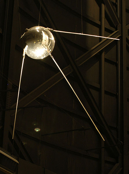
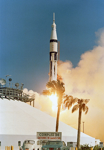
Rocket development progressed through the 1950s with specific emphasis placed on inter-continental ballistic missiles (ICBMs) until something interesting occurred that involved a different group of scientists working in a different underdeveloped part of the world. That interesting thing was called:”Cпутник-1”, which means: “fellow traveller”.
In English it’s written and pronounced: Sputnik and it translates as: “Oh holly crap, those SOBs did what, and put it where, and we haven’t even considered doing anything like this yet?” At 19:28:34 UTC (that’s about 2:30 in the afternoon to you and me), on 4 October, 1957, the world changed. At that time a Sergei Korolev designed R-7 rocket successfully left a launch facility in what is now called the Baikonur Cosmodrome. This event officially started the “Space Race” by putting a small basketball sized satellite into low Earth orbit.
The effect this had on Cape Canaveral was dramatic. Launch sites were built up and down The Cape until there was no more room for additional facilities. The area boomed with the influx of military personnel, civilian contractors and all the necessary support facilities and businesses that are required for the up keep of the scientists, designers, engineers and pilots with the “Right Stuff” to make certain we did not loose this new race. NASA's Project Mercury and Gemini space flights were launched from Cape Canaveral, as were the ill-fated Apollo-1 and far more successful Apollo-7 missions.
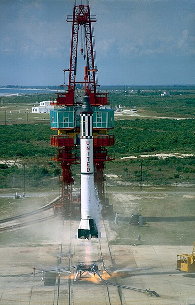
Flight: MR-3 (Freedom 7) turning Allen Sheppard into the first American into space
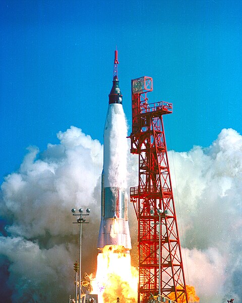
Flight: MA-6 (Friendship 7) launching John Glenn into earth orbit
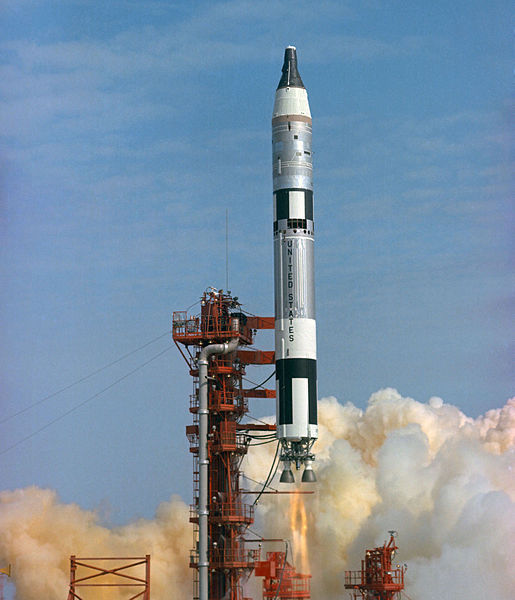
Gemini-3 returning Gus Grissom to space along with first timer John Young
Apollo-7 The first successful manned launch and test of the Apollo command module
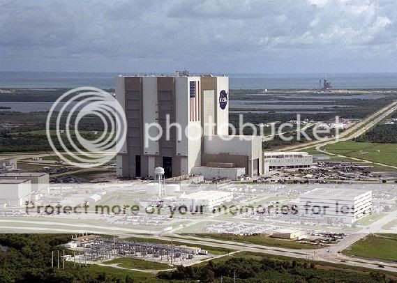
But one thing was clear even at the beginning of the moon missions. Canaveral was running out of room. The solution was to build a separate facility just to the northwest on Merritt Island. This area is actually considerably larger the Canaveral itself and includes the large Merritt Island National Wildlife Refuge and one very fine National Seashore known as Playalinda Beach. (Which is actually redundant because “Playa” already means beach. “Linda” means beautiful and Playalinda is exactly that, so spend some time there if you get the chance.) Anyway… The Merritt Island facility is run by NASA in association with the USAF and is technically separate from the Air Force facility on the Canaveral shore, but the whole area is still referred to as “The Cape. The three most iconic sites at KSC are the Vehicle Assembly Building (VAB) and launch pads 39A & 39B, from which all the Saturn-5 rocket and later Space Shuttle launches occurred.
VAB under Construction
(This is the first job that drew my Grandfather down into the area)
The VAB in its current configuration with launch Pad 39B in the back ground
One of the “Mobil Launchers” carring Apollo-15 down to the launch pad
Now a days there is a bit more going on at the Cape than just space exploration. Back in 1950, during the same time frame as the first rocket launches, the Army Corps of Engineers began the construction of a port facility at the southern end of the Cape. The deep-water port was originally intended to allow the berthing of range instrumentation and cargo ships, but was later expanded to service ballistic missile submarines and commercial vessels. Now known as Port Canaveral, it is home to a commercial port,
a Coast Guard station (good to know that they got your back),
a fine seaside park (Jetty Park)…
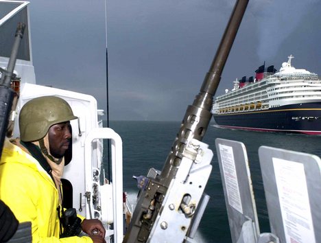
and of course several cruise ship lines
(including one operated by a company we all know and love)
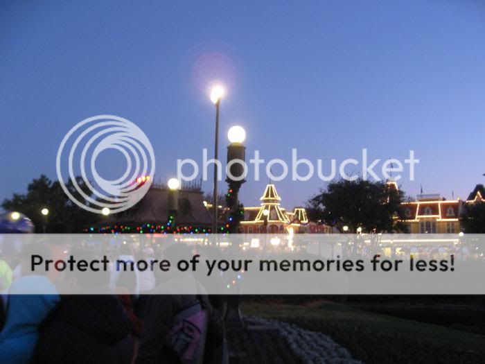
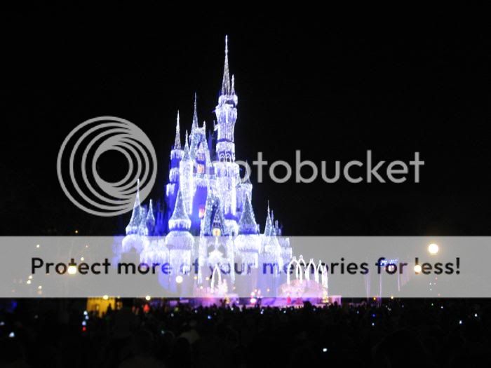
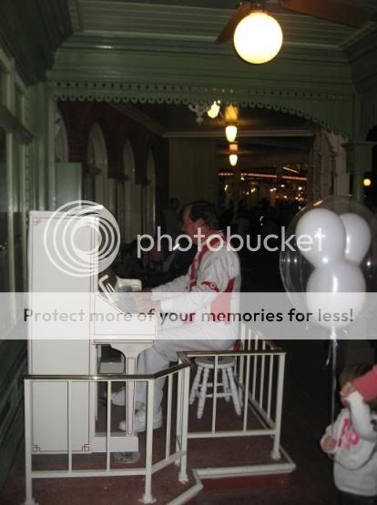
Well… That just about wraps up my little unnecessary dissertation on Port Canaveral. This free thought experiment was brought to you courtesy of my in ability to stay on topic and the fact that I just don’t have any pictures for the next couple of sections of this TR (so I tossed a few bits of visual candy in here). I warned you to just scroll on down to the next section in the beginning of this post, so if you actually read through this morass, you’ve got no one but yourself to blame.
We now return you to our previously scheduled program already in progress…
Even when we went in September, with low overall crowds, we felt that EMH made the parks more crowded.


 Ok, you worked pissing on an electric fence into a TR. I'm impressed.


 I guarantee that well be doing a lot of off-season couples only touring of The World, in a few years.