Captains Log: Monday, 21 July 2014.
1:24 a.m.Baby Drew has been fussy in the pop-up tent from the beginning. It took him an hour to get to sleep in it. Now hes fussing again. After nursing him, we give up and put him in his car seat.
4:18 a.m.Wow! Three straight hours of sleep before hes fussing again.
5:32 a.m.Well, I guess were up for the day. Yay!
7:27 a.m.Had a nice breakfast at the hotel. It was a standard hotel breakfast made immeasurably better when they brought out the huge tray of donuts halfway through our meal. Now were on the road with a full day ahead of us. Were headed east out of Cedar City and into the mountains on Route 14.
Disney Parks veterans are well aware of the Rope Drop Strategyi.e. the Get Your Butt Out Of Bed Early And Beat Everyone Else To The Parks So You Can Ride The Popular Rides Before The Lines Get Long And The Kids Start Whining And Driving You Crazy strategy. Weve found that the concept of Rope Drop works pretty much everywhere you go. If youre willing to get up early, you can see even the most popular places before they are overcome with crowds. And even if youre not willing to get up early but have a baby who refuses to sleep, the concept still works.
Route 14 is a beautiful drive, continually climbing the mountains in the Dixie National Forest. Yesterday, temperatures were over 100 degrees. This morning, at the higher elevations, theyre hovering in the 50s. We actually have to break out our sweatshirts. We also have our first wildlife sightinga marmot that I nearly flatten as he shuffles off the road.
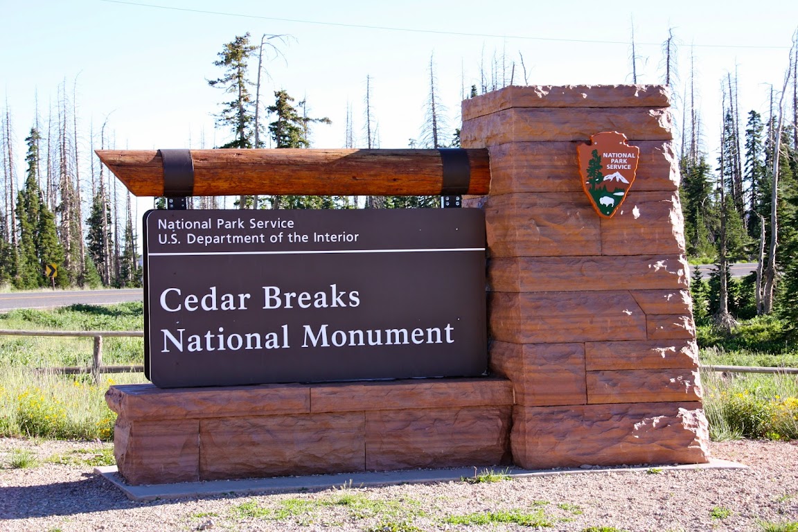
8:30 a.m.Weve reached our first stop:
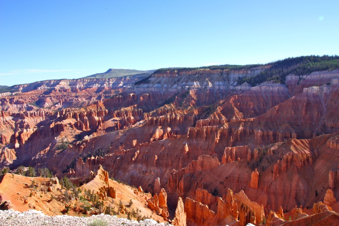
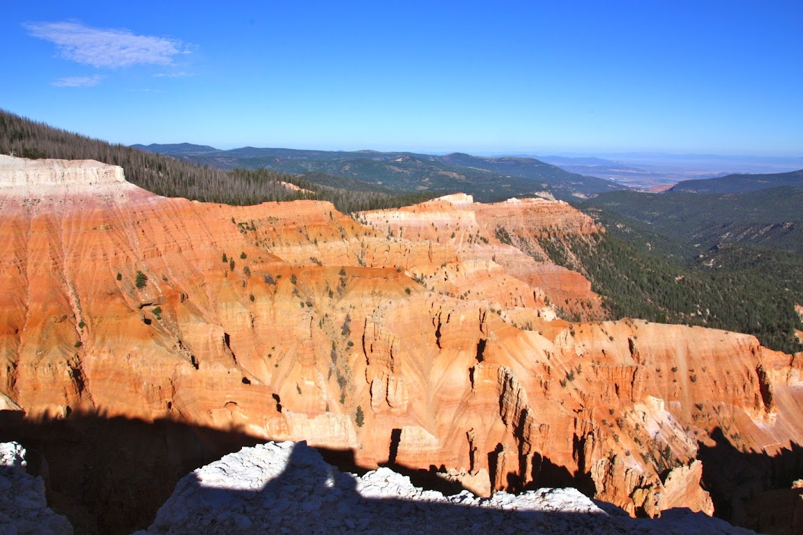
Cedar Breaks National Monument.
Youve probably heard of Bryce Canyon National Park. It happens to be our next destination, and is famous for its unique rock structures formed by erosion and the elements. Cedar Breaks, although less well knows, is basically a mini-Bryce Canyon. It consists of an amphitheater facing west, with exposed red rock that through exposure to wind, rain, and the pressures of time has formed unique structures called
hoodoos.
Im not quite sure where that term came from, but my best guess is that early explorers and settlers needed a word to describe these formations, and whatsit and thingamajiggy were already being used somewhere else.
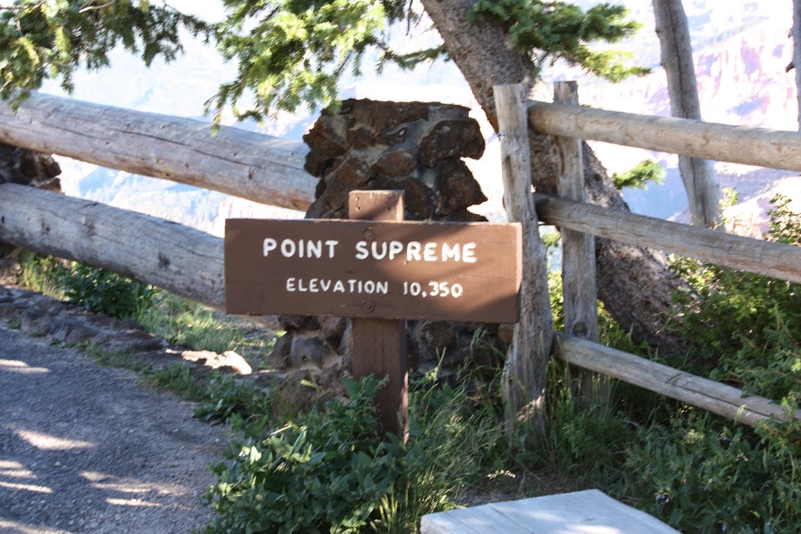
8:37 a.m.After Daves first bathroom break of the day, we walk up the short trail to see that the visitor center isnt open yet. We head on towards the overlook and discover that we are over 10,000 feet in elevation for the first time since
last summers ascent of Mt. Haleakala on Maui.
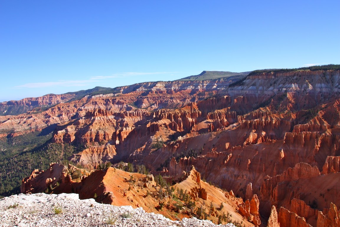
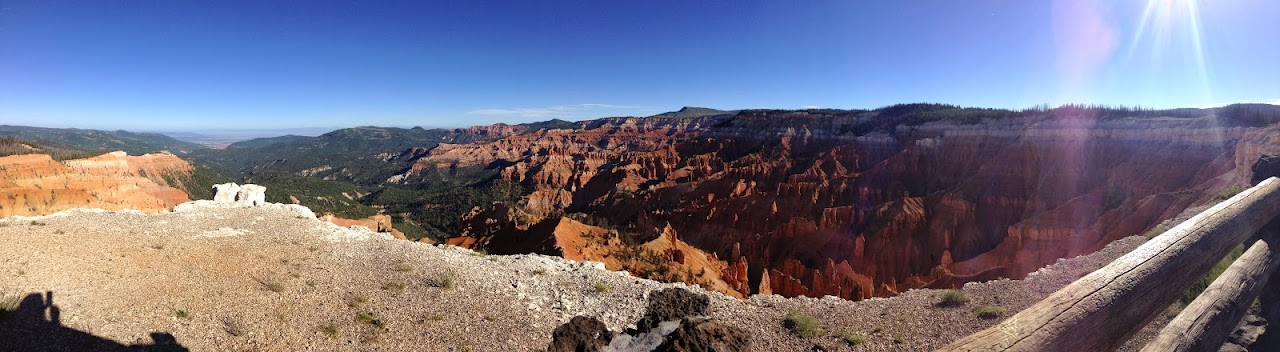
8:43 a.m.The weather is cool and windy, but we forget about all that as we soak in the views of the Cedar Breaks amphitheater.
Sarahs panoramic:
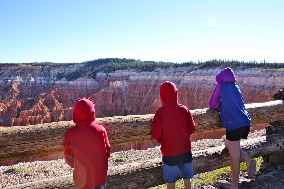
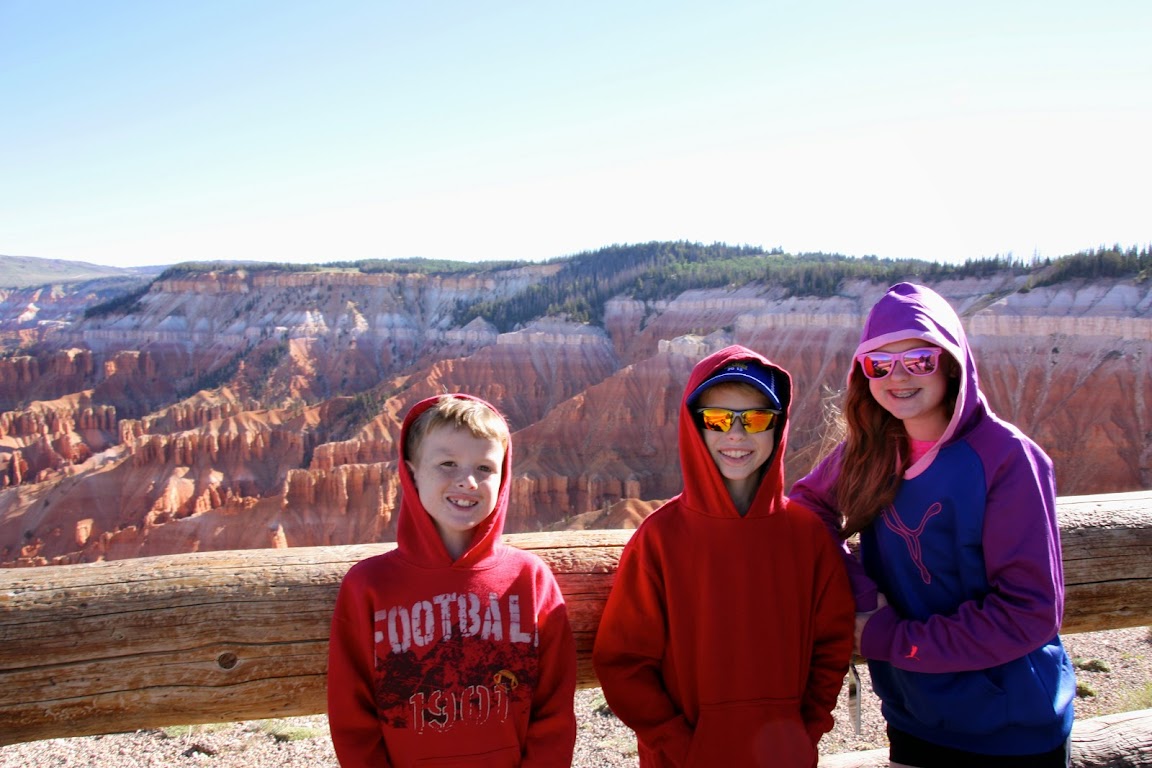
Its fun to watch the kids run up to the fence, get their first glimpse, and say, Whoa
.
Meanwhile, Im not sure where Scottys Inspector Clouseau mustache came from.
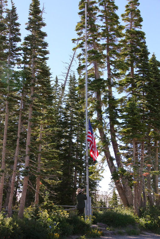
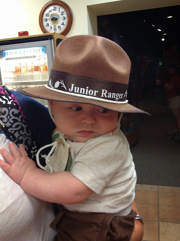
8:53 a.m.the visitor center still isnt open. This is going to make it tough to get our coveted
stamp in our National Park passport.
9:00 a.m.The park ranger shows up and opens the visitor center. We get to see her raise the flag.
The park entrance fee is $4/adult, but we show our Super-Secret
Stonecutters Card to add another $8 to our tally of savings. Got our stamp, too.
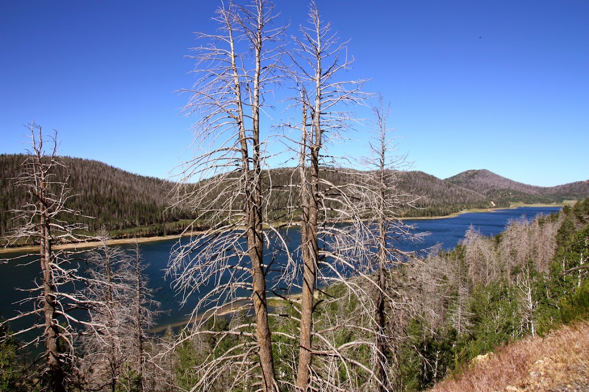
9:15 a.m.Were on our way to Bryce Canyon. Along the way, theres an overlook for Navajo Lake.
As you can see, its a gorgeous drive. Many Wilderness Lodge-style log cabins dot the area.
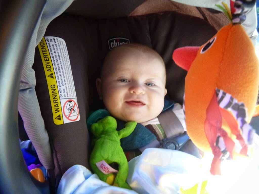
10:12 a.m.We were moving along fine until we hit a portion of U.S. 89 thats closed down to 1 lane due to construction. Stupid highway engineers. How dare you maintain the nations infrastructure! At least our travel buddy is doing ok.
Why is he so happy? Because he no longer has to do a #2. Its all over his shorts, instead. Ill blame the crappy diapers. You can decide if thats figurative or literal.
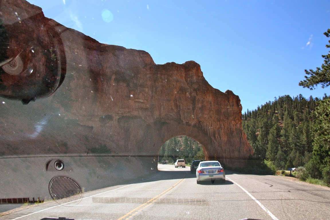
10:30 a.m.Baby shorts hastily changed, weve turned onto Route 12, which takes us through lovely Red Canyon. You get to go through a few awesome rock tunnels on the way, because highway engineers are amazingly cool people.
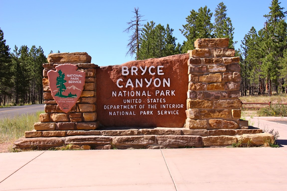
10:45 a.m.We made it!
Bryce Canyon National Park was formed in 1928. The rock formations here face to the east, and again are shaped by the elements into imposing towers and rock walls. It was named after a Mormon settler named Ebenezer Bryce, who, when asked about his impression of the geological wonders of the area, demonstrated a keen understanding of the majesty and grandeur of the region, saying, Well
its a hell of a place to lose a cow.
Bryce Canyon is actually a misnomer. Its not a canyon. Theres no river carving rock walls through a valley. But tourists dont come all this way to see Bryce Regional Erosion, so the canyon name stuck to entice visitors. Judging from the fact that they now have a shuttle bus system to help ferry people around the park, Id say it has worked.
10:53 a.m.Our first stop is the visitor center, where we get our second passport stamp of the day and use our Get Out Of Jail Free card to avoid paying the $25 entrance fee. Our entrance fee tally is now at $68 saved, and were only 3 days into the trip! I had to rush in ahead of everyone to accompany Dave, who announced as we drove into the park that he really, really needed to go.
Weve learned the root cause of the problem. When we first talked about going to the desert, Julie stressed the importance of proper hydration to the kids. Stressed, emphasized, threatened with bodily harmyou get the picture. So for the last 3 days, Dave has been draining water bottle after water bottle in the back seat of the van. But hey, at least hes hydrated. And he listens to his Mommy.
We also wandered the gift shop. Just to see if anything caught our eye.
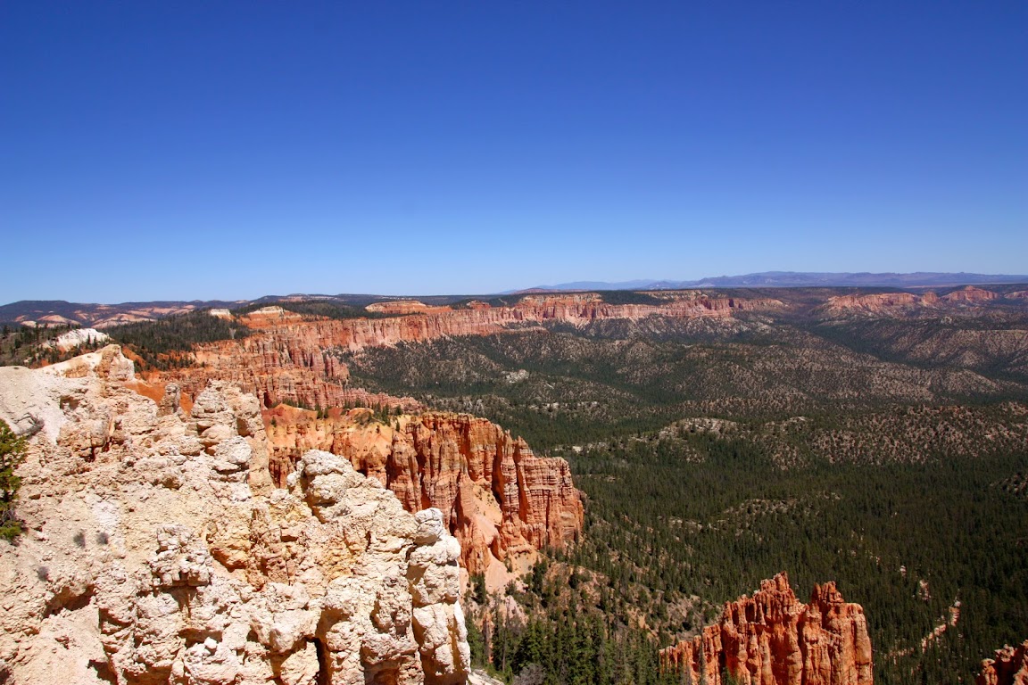
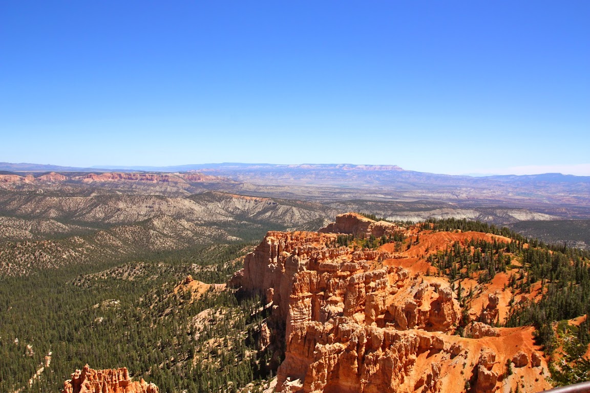
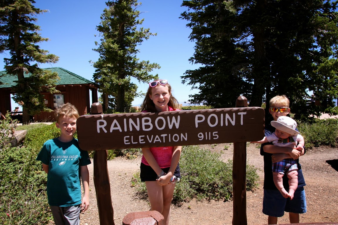
11:20 a.m.We get on the road to see the sights. The road to the end of the park is 18 miles long, and its suggested that you drive all the way to the end first and then work your way back. This is due to the fact that the entrances to the overlooks are all off of the northbound side of the road, so its easier to make right turns in and out. So we head on down the road to Rainbow Point, the last stop in Bryce Canyon.
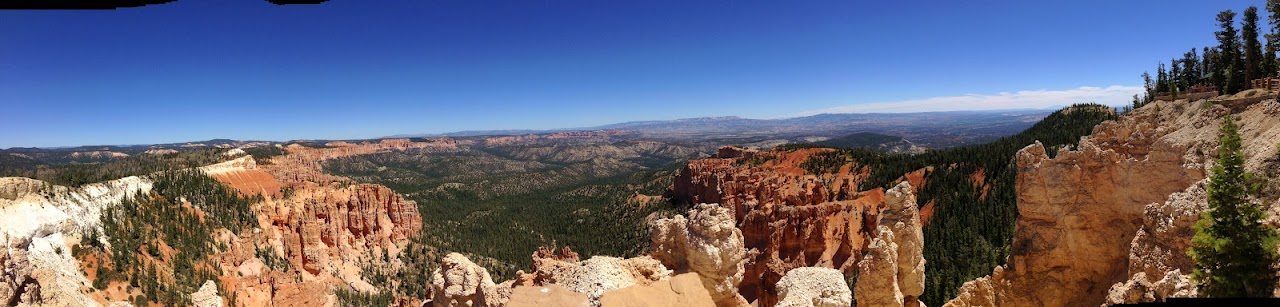
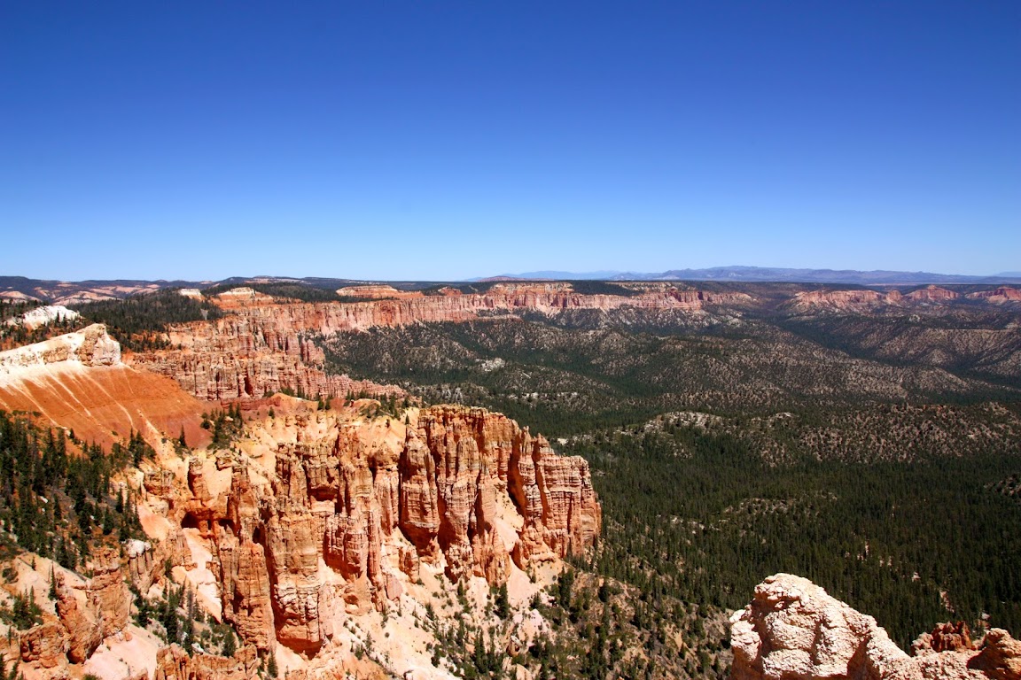
11:43 a.m.Welcome to Rainbow Point.
The views here are stunning. You can see for miles in the clear mountain air. When you live in a flat state like Delaware, where the highest point is measured by whoever can stand tallest in the tailgate of a pickup truck, this kind of panorama just does not grow old.
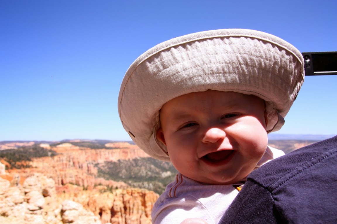
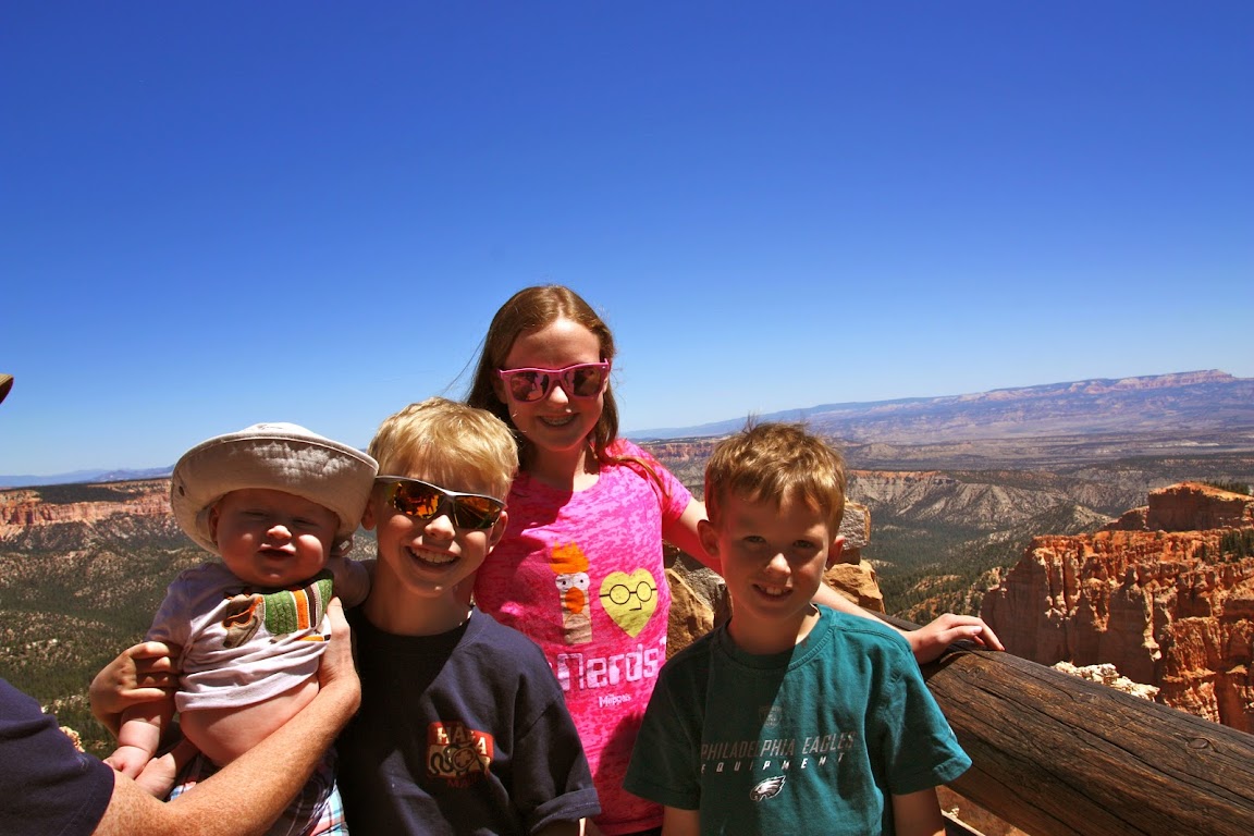
What does Baby Drew think?
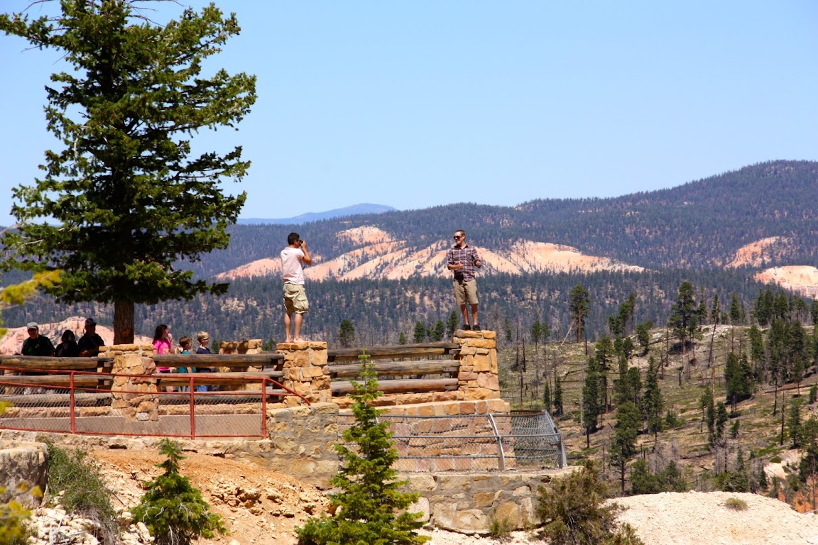
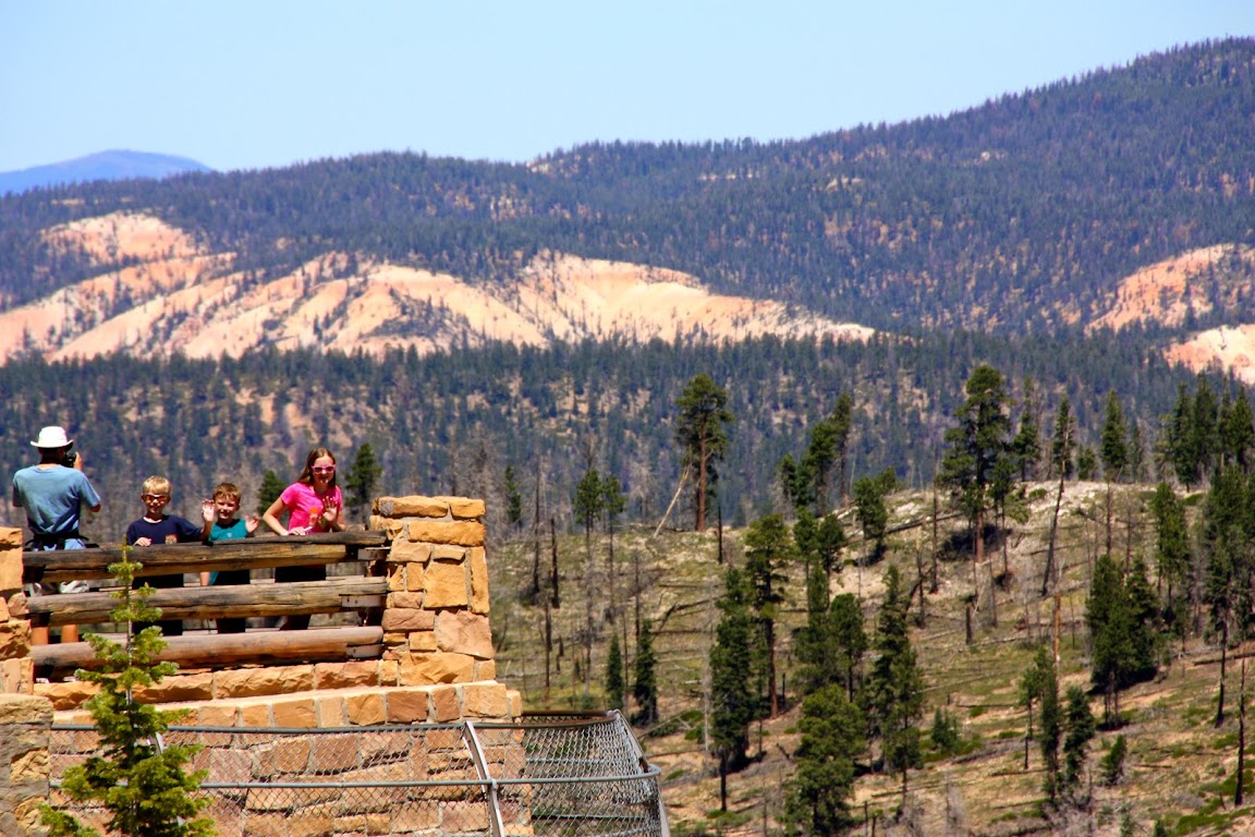
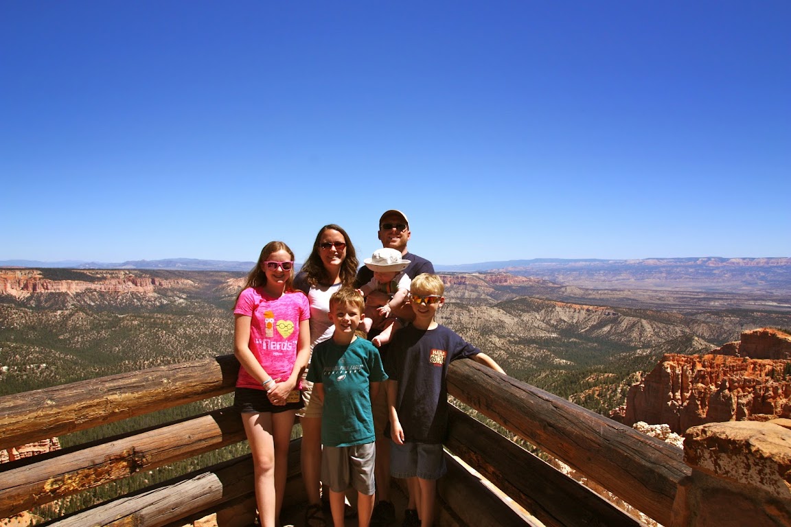
We look down the way to our left and see another observation point. The kids head down while Julie and I stay back to try and get a cool picture of them. As we wait, we get a rare wildlife sighting. I present to you
Touristus Idiotia, seen here in their native habitat:
See that metal fence below? No way its wide enough to catch them if they fall. All it would take is one gust of wind. The guy on the end actually tightroped his way along the top beam to get there.
Panoramic:
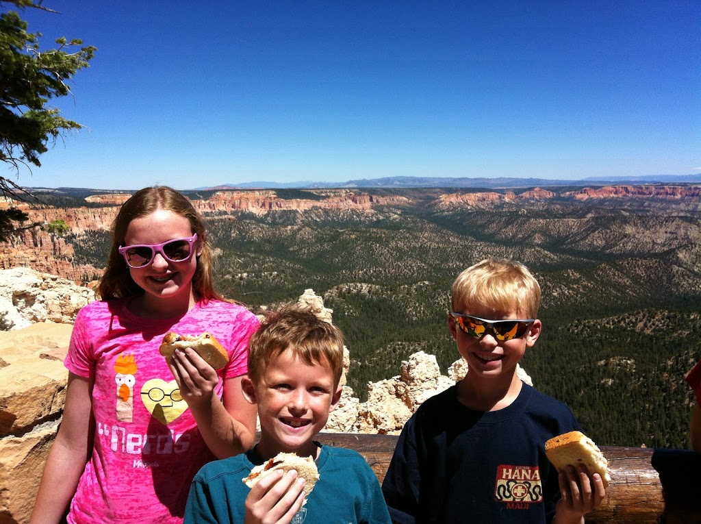
12:00 p.m.In keeping with tradition, this looks like a great place for a PB&J sandwich.
And I just included this picture because it reminds me that no matter how much noise we made, Drew was utterly fascinated with the sign.
Coming Up Next: Hoodoos! Saying that doesn't get old, either. And if we get far enough into the day, maybe some pie.

LOVE it! That Christmas card photo was SO close!

I guess just another family member tired of your dam jokes.


Sorry I forgot to edit my sentence, so that just looks rude. I meant to say, "Was wondering when someone would bring this up! That was so shocking and sad
"

 I'm tough to offend.
 ")