GPS Logging - Now with a review of the logger I purchased

BirdsOfPreyDave

Disney Lover, DVC Member, SSR Fanatic
DIS Lifetime Sponsor
Joined
Jul 22, 2006
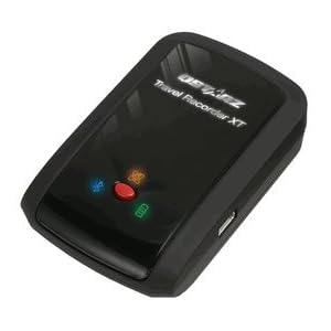
After spending many hours in the past week dragging photos onto the map in Lightroom 4, I decided to look into a GPS option. For the first time, I can say I've found something to be disappointed about with regard to the decision I made many years ago to go with Canon rather than Nikon. While there appear to be many GPS options for Nikon DSLRs in all price ranges, direct connection of a GPS to Canon DSLRs only seems to be possible with their top-of-the-line 1D X, with support for 5D Mark III and 7D "coming soon" in yet-to-be-released firmware upgrades. As a 60D owner, I guess I'm forced to go the route of GPS logging followed by syncing in post.

I do have an Android-based smart phone, and I understand there are apps I could download to allow me to use it to perform this function. (This is what was recommended in the Lightroom training video I watched on Adobe's YouTube site.) However, I already have issues with my phone dying before the end of a long Disney day, so I really don't want to run an app that's going to be using the GPS radio constantly. I'd much rather spend a little money and have a dedicated device I can attach to the camera. (I'll probably put it in one of the "Joey" pouches on my Black Rapid strap.)

Web searches aren't getting me very far in finding the right device -- I'm finding a bunch of piecemeal info rather than any kind of buying guide that applies to my situation. (BTW, who knew there was such a large market for spying on where your kids/spouse drive their car?! There are even GPS jamming devices if you are that kid/spouse. Brother!)

From what I've read so far, here are the features I think I'm looking for:

  • Consistently accurate and reliable GPS coordinates
  • Small enough to fit in a "Joey" pouch, so not bigger than an iPhone
  • Set it and forget it. I want a simple way to turn it on when I leave the hotel room, and off when I return.
  • Direct USB connection to the laptop would be nice, rather than having to swap out a memory card.
    • Probably wouldn't use bluetooth, as my WDW laptop is too old to have it. I could install a dongle if a device that's right for me in every other aspect only uses bluetooth
    • No klunky serial port interfaces or mock serial port interfaces.
    • I'd really prefer a device that attaches to the computer as a disk drive
  • Creates a GPX file directly.
    • I'll be using with Lightroom 4, and would rather not have the extra step of converting a KML file to GPX.
    • If such a thing exists, a device that plugs in to USB, looks like a disk drive to the computer, and already has the GPX file on it would be perfect!
    • Would rather not have a device that requires a special software package to create the files
    • Definitely don't want a device that uses software that actually tries to edit the exif data in photos directly. (I shoot in RAW, so I don't know that this would even be an option.) I want Lightroom to do the syncing.
  • AA batteries would be nice, as I could use the Eneloops I already have in the camera bag for the speedlight, and not have yet another charger to deal with
  • Storage and battery capacity to log for 12-18 hours
  • Would like to keep the purchase under $150 if possible
  • LEDs, displays, or the ability to use the device as a GPS or compass is not important to me.

Does anyone use a GPS Logger? Any advice or product recommendations would be appreciated.
 
The Canon 6D has integrated GPS. I'd expect to see it in some of the next generation of crop bodies from them.

I've only used the eye-fi and it's not that great, but it's also not a stand alone device like you're talking about. I don't like it because I don't like taking my GPS tag from the nearest wireless hotspot.
 
I do my GPS logging directly with a GP-1 connected to my Nikon, but you're on the right path. Lightroom allows you to upload a GPS track and then you can add your photos to different waypoints on the map.

You should be able to find a Garmin eTrex that fits your needs. I have one somewhere around here when I used to do tracklogs. Check eBay for some older models to keep the price down.
 
The mapping feature was something I was really excited about when Lightroom 4 came out. But after playing around with it, I have discovered that I have never really needed to know where a photo was taken. The first couple of times, it was cool to see pins all over on the map. But after the coolness factor wore off, I haven't found it to be that useful for anything practical I do.

I guess it would be a nice to have if it came with the camera (like the 6d), but its not a feature I would make an effort to acquire.

Can I ask how the OP uses the GPS data once you have it? What are you charting/tracking? How do you use the information after you have it?


Can I ask how the OP uses the GPS data once you have it? What are you charting/tracking? How do you use the information after you have it?
I'll admit there's some element of "hey, this is cool that Lightroom and Flickr can both do this." What I'm hoping it will eventually do is save me from having to add as many keywords for searching purposes. I can usually remember where I shot something I want, but often can't remember which trip it was from in which year.

I'm thinking it will be a lot easier to click on a map near Space Mountain and find a picture that was nearly automatically geomapped than it would be to search by text, which would have meant keywording the photo with a level of detail such as "Walt Disney World, Magic Kingdom, Tomorrowland, Space Mountain." I know it will be better than scrolling through 10,000 WDW pictures to find the one I'm thinking of, which is pretty close to where I am now with my catalog. Most of it, I only have keyworded down to the park or resort level. That still leaves a lot of pictures to look through.
 
Can I ask how the OP uses the GPS data once you have it? What are you charting/tracking? How do you use the information after you have it?

I'm not the OP, but I'll share an answer.

It's searchable metadata. I use Aperture rather than Lightroom, but the principle is the same. I can build search queries based upon locations, or Smart Albums (Smart Collections in LR).

Let's say that I want to automatically group all of my shots at WDW into one Album. All I have to do is zoom in my map to show the area, and then I can create a new Smart Album from View. As I add more photos with location data in that area, they show up in the Smart Album.

Another reason to use it is for other people to search for photos at a location and perhaps find yours. It's one more way to make a sale.
 
After comparing multiple units, I finally decided on the QStarz BT-Q1000XT. Although it doesn't match some of the criteria I listed, above, I'm still happy with the purchase. It was $112 via Amazon.com.

31lf1W0JNTL._SL500_AA300_.jpg


The unit is about the size of a zippo lighter, so it's easy to accommodate while taking photos. I keep mine in a Joey-1 pouch on my Black Rapid camera strap. That way, the GPS logger is never separated from the camera. I keep it in the pouch I use to carry a plastic bag for rain emergencies, rather than the one that has my spare battery and memory cards. (I'm not sure if that makes a difference, but I assumed this would be the pouch with less "stuff" in the way that could possibly block a satellite fix, and I also wasn't sure about having my memory cards right against a radio receiver.)

I initially thought I wanted a logger that used AA batteries. This one does not. It uses a Nokia phone battery, and is charged using a standard USB cable. It came with a small 1" cube transformer that the USB plugs into, so it can either be charged with the computer or an outlet. I know I said I didn't want another charger to deal with, but this wound up being a compromise I was willing to make.

Another of my criteria turned out to be unrealistic. I could not find any unit that would plug directly into the computer via USB, identify itself as a disk drive, and allow the GPX file to be loaded directly into Lightroom from the GPS. The QStarz does connect to the computer via USB, but requires a special software package to communicate with it. Fortunately, this is a simple tool that allows you to quickly pull the file off the device and save it as a GPX file. The process isn't complicated or time consuming enough to be a big issue now that I've tried it a few times. (The package comes with a second software package that is much more involved. It allows you to save your GPS tracks, explore them using Google Earth, and import photographs into its own database. I don't use this software, as Lightroom gives me all I need in that regard and is already the database I'm using for cataloging my photos.)

The manufacturer claims the BT-Q1000XT will log for 42 hours on a single battery charge, and has memory for recording up to 400,000 waypoints. I've not come close to testing either of those constraints. Because I will almost always have access to a laptop at the end of any day of taking photos, this capacity will be way more than adequate for my needs.

The unit is user configurable (using the same software that allows you to extract the data to a file) to capture waypoints based on either time or distance travelled. The unit also has a vibration sensor that can be turned either on or off. This sensor tells the unit to stop logging if it doesn't sense any movement, which allows it to extend both the battery and storage capability. I do not have this turned on. There is a warning in the documentation that there may be a slight delay between the unit sensing movement and the renewal of logging. As I said, I don't think I'll ever come close to either the battery or storage limitations, so there's no need to use this conservation mode. On the two shoots I've done with the logger so far, I had it set to record the coordinates once every five seconds (the default). I've now set it to log once every second.

The unit has several LEDs and a beeper to signal its status.

On the several occasions I've used the logger since it arrived, it's been a fairly easy process. In the driveway before I leave the house, I turn the unit on and wait for it to acquire the satellites. This takes about 15-30 seconds. It gives a couple of beeps and I slip it into the Joey-1 pouch. I don't think about it again until I get back home, when I switch it off.

One step I did not do on the two times I've used the unit, so far, is to verify the time in the camera. On the first use, we went over to take some photos of a new swing set being installed for our granddaughters. Because we were in their back yard for the entire time, the fact that my camera's clock wasn't perfectly set to the true time used by the GPS satellites wasn't a big deal. I never noticed it. However, on our outing the next day, we went to Busch Gardens. When I loaded and mapped those photos, I could see something was dramatically wrong. Pictures were showing on the map in locations that were way off from their true location. When I checked, the clock in my camera was off by six minutes. You can walk a pretty good distance in a theme park in six minutes, and my mapping results showed that. I deleted the GPS coordinates from those photos, and using the time offset setting in Lightroom, applied a 0.1 hour offset and tried again. The pictures were placed on the map perfectly.

Using an application I found online, I now have my laptop's clock synced to the atomic clock on a regular basis. Connecting the camera to the laptop and using the EOS utility, it's a simple step to sync the camera's clock to the laptop's. I don't expect I'll have to do this often -- in fact, having done it this one time may have been enough. I'm not sure how true the clock in the 60D is.

As to the QStarz BT-Q1000XT's performance, I can say I'm quite happy with it. It's not perfect. When you look at the track, you will see a "spike" thrown every once in a while where it picked up a bad location. For example, the swing set pictures taken in the back yard show most of the photos being shot from various locations within the yard. However, there are a handful of them that show as having been taken from just on the other side of the fence. This wasn't the case, as I never left the back yard. At Busch Gardens, some of the photos taken during a show at the FestHaus had a similar issue. Most of the pictures of the show were correctly displayed in the middle of the building at the correct location for where our seats were. A half dozen, though, were shown on the paths around the building. Granted, sitting inside a building is probably an extreme case of challenging the unit to maintain its connection to the satellites. The pictures were close enough that it was an easy enough task to drag them over to where they belonged on the map. (Because I noticed several pictures tied to the same bad coordinate in a few cases, I've changed my logging from every 5 seconds to every second. I'm hoping this reduces the number of photos with a bad location.)

Next Saturday, I'll be giving the unit another test as I use it during Scott Kelby's Worldwide Photo Walk. Norfolk certainly isn't NYC, but I will be shooting in a downtown area with some high rises. We'll see how the unit does when surrounded by buildings.


A

I initially thought I wanted a logger that used AA batteries. This one does not. It uses a Nokia phone battery, and is charged using a standard USB cable. It came with a small 1" cube transformer that the USB plugs into, so it can either be charged with the computer or an outlet.

Another of my criteria turned out to be unrealistic. I could not find any unit that would plug directly into the computer via USB, identify itself as a disk drive, and allow the GPX file to be loaded directly into Lightroom from the GPS.

Glad to hear you got something that worked well for you. I thought I'd throw out another, similar, option for others: the Amod AGL3080. It does use AAA batteries and is recognized as a drive directly. However, it only generates NMEA logs and not GPX. (There's always a compromise.) (There is software, GPSBabel, that will convert.) One trick I've done to synchronize clocks is to create waypoint, which flashes an LED on the device, and take a photo of this. I can then look at the logs to sync the clocks.
 

GET A DISNEY VACATION QUOTE

Dreams Unlimited Travel is committed to providing you with the very best vacation planning experience possible. Our Vacation Planners are experts and will share their honest advice to help you have a magical vacation.

Let us help you with your next Disney Vacation!


facebook twitter
Top