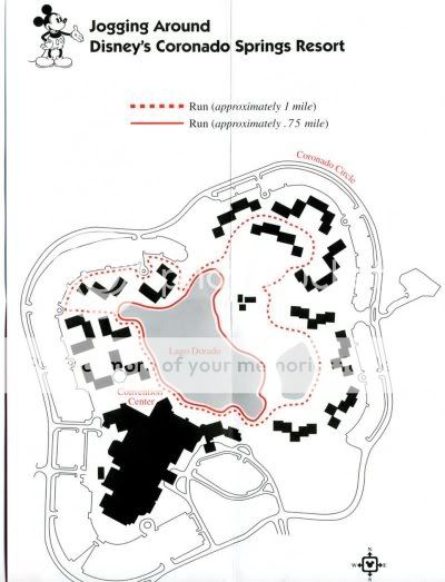
CSR - Distance around lake??
- Thread starter Raksha
- Start date
 :
:

-
A FIRST LOOK at the Stunning Storybook Castle Aboard the Disney Adventure Ship
-
New Paseo Dining Experience in Downtown Disney at Disneyland
-
Disney Hidden History: Walt Disney's Secret World
-
Is Disney Cruise Line's Vacation Protection Plan Worth It?
-
Girls Crew Disneyland Necklaces and New Stocking Stuffers
-
Live Streamers at Disney Restaurants - Should There Be Limitations?
-
Please Do the Disney College Program
Receive up to $1,000 in Onboard Credit and a Gift Basket!
That’s right — when you book your Disney Cruise with Dreams Unlimited Travel, you’ll receive incredible shipboard credits to spend during your vacation!
CLICK HERE
That’s right — when you book your Disney Cruise with Dreams Unlimited Travel, you’ll receive incredible shipboard credits to spend during your vacation!
CLICK HERE