Real Life Update:
Happy New Year! I hope everyone had a nice, restful holiday season. I wasn't at work, so mine was great.
Just wanted to announce that we are now officially under a Baby Watch. Julie is officially due on Feb. 5, but she was 2 weeks early with David and 3 weeks early with Scotty, so we're in that window when it could happen at any time. Feel free to send in your guesses as to the gender, birth date and time, weight, etc.
Now, back to our regularly scheduled program.
________________________________________________________________
They call it The Big Island for a reason.
Our goal for the day was to explore Hawaii Volcanoes National Park. As the crow flies, its about 48 miles from the town of Kona. The only thing standing in the way is the most massive mountain in the world.
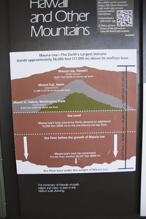
Mauna Loa is still an active volcano, and stands 13,680 ft. above sea level. However, measured from its base at the ocean floor, its total height is over 30,000 ft., which would make it taller than Mt. Everest and the rest of the Himalayas. Because its eruptions have generally tended toward slow, smooth lava flows, its known as a shield volcano, due to its gently sloping shape to a cone at the top. This lava flow has built up the mountains volume to a point that dwarfs most other volcanoes in the world. Well have a picture of a diagram later that helps illustrate this.
Anyway, why do we care? Well, that mountain was in between point A and point B for us. Theres no road over the top of the mountain. So you have to go around it. Which meant that our drive was going to be closer to 100 miles on a curvy 2-lane road cut into the sides of the mountain slopes. The speed limit was 35 mph for a good portion of the drive, getting up to 50 mph on the flatter sections. In other words, this was going to take a while. Thered better be something worthwhile at the other end. Like natural phenomena of a kind not normally witnessed in Delaware, for example.
We set off fairly early in the morning, as we not only had a lot of ground to cover, but a lot we wanted to see. Our first stop was for breakfast: there werent many choices south of town, but the guidebook had made mention of a little hole-in-the-wall bakery called Coffees n Epicurea. And no, I have no idea what epicurea means and was too lazy to look it up. Im guessing its a euphemism for pot.
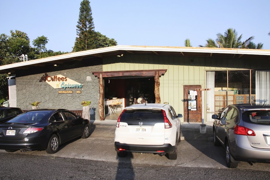
You know we love our obscure hole-in-the-wall joints. Each one produces a good story. Unfortunately, some of them produce stories for the wrong reasons. We walked into the bakery hoping for some glorious pastries that would make a complete and satisfying breakfast. What we got was a single forlorn glass display case with a few scattered pastries inside. There was a menu helpfully posted on the wall behind the case that mentioned cinnamon rolls. Who doesnt like a good cinnamon roll for breakfast? We didnt see any in the case, though. I figured that since this was a bakery, they were probably making more in the kitchen.
Eventually, a tall, lanky, overly-tattoed worker ambled his way over and asked in perfect Stoner/Surfer speak, Uhhh
like, can I help you?
I asked if they had any cinnamon rolls. He looked down at the case, with an expression on his face as though he were trying to figure out why
Andy Reid would call a timeout right after the two-minute warning. Finally, he looked up and said, Uhhhh
looks like we do not.
This was the last stop before we left civilization, and the kids were starving. So, we were limited to the choices in the display case. There were 4 apple turnovers, and I figured that was a safe choice. Scotty thought that sounded kind of exotic, so he went with a plain croissant. Now we needed some coffee. That involved moving to a separate table and menu. Here in the heart of the Kona Coast, I wanted 100% pure Kona coffee. Nothing but the good stuff, please. I was directed to a small dispenser exactly like the ones you would find in the breakfast room of your local Holiday Inn Express. The coffee was fine, but not exactly what I had imagined going in. Julie got fancy and decided to get a mocha latte. Again, this caused much consternation for Stoney, and he furrowed his brow much like I used to do whenever
Andy Reid would call another screen pass on 3rd-and-17 in the 4th quarter.
Uhhh
were, like, out of mocha, Stoney announced.
If you stopped by a bakery specializing in coffee and pastries at 7:00 in the morning, you wouldnt expect them to be fully stocked, would you?
Anyway, he offered to try and put in some chocolate ganache from the bakery. After waiting a while, he was finally done and we were on our way. Julie said her latte tasted like Valvoline. The apple turnovers were actually pretty good, very light and flaky (and messy in the rental car). The only downside was that there was less than a teaspoon of apple filling in each one.
Keep in mind that we hadnt made a Costco run since we were only going to be on the island for 2 days. There was no PB&J or other snacks in the car.
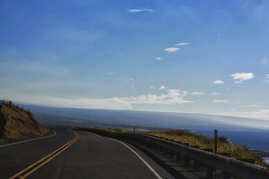
We drove on, winding our way around the southern tip of the island. It was slow going for a while, but eventually the road flattened out, development became scarce, and we could drive a little faster (not too fastthis road is notorious for speed traps, according to the book). With every mile, I reminded myself that Id have to do this drive again in the evening. So we had that going for us, which was nice.
At one point, there was a side road leading to the Southernmost Point in the United States. Its helpfully called South Point Road. We had considered it, but its an 11-mile side trip down a partially dirt road, and theres no memorial or anything very memorable at the end. You just stand at a cliff edge and proclaim yourself to be standing at the southernmost point in the U.S. We figured we were already further south than anywhere on the mainland and could see the end from a convenient overlook on the main road, so that was close enough for us.
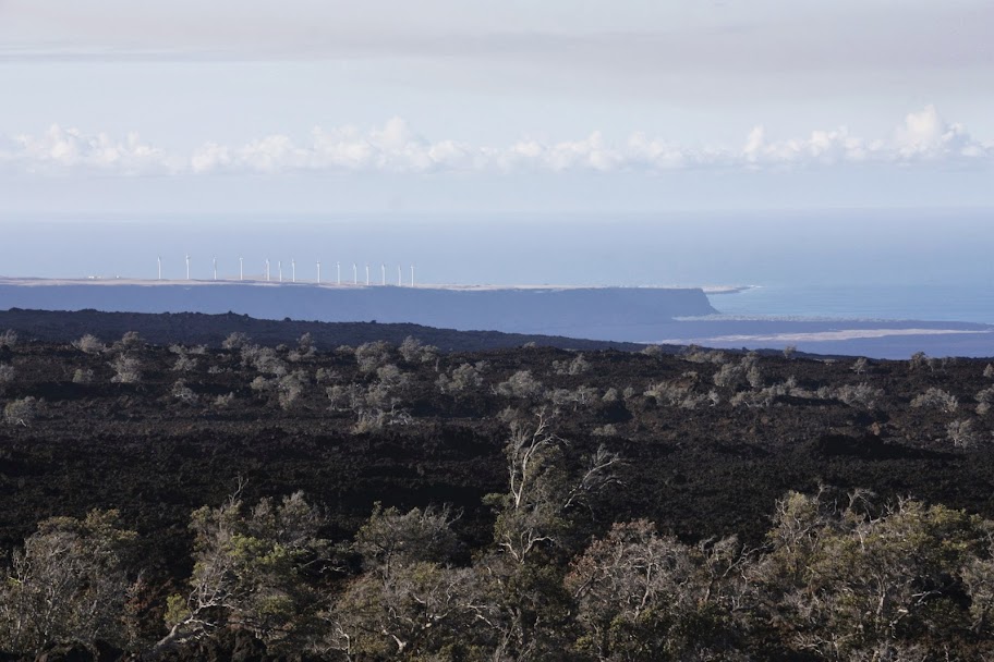
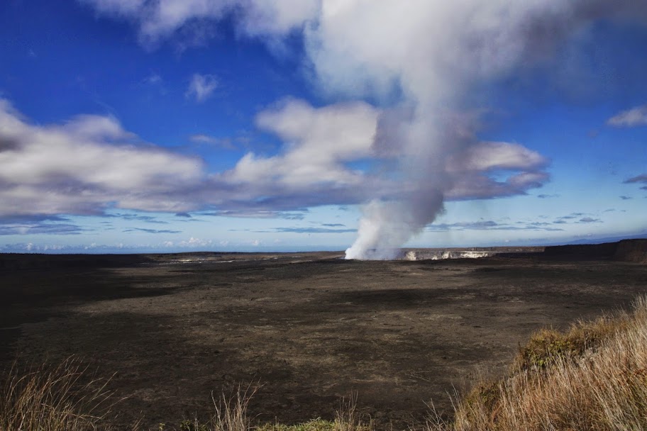
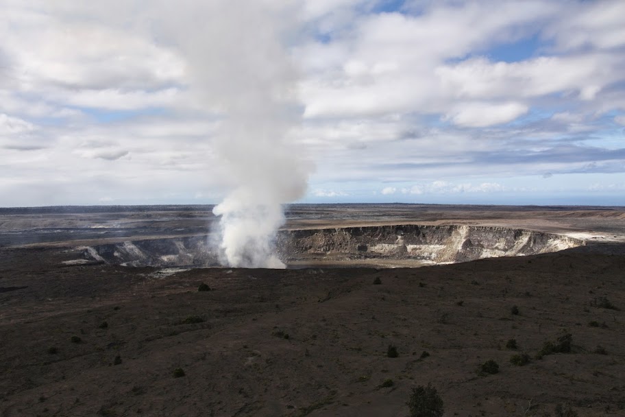
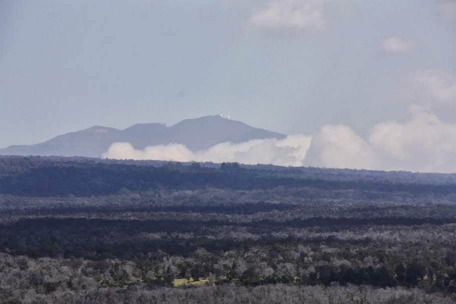
We rounded the mountain and started heading north, and back uphill. We were about 30 miles away from the park entrance when we got this view. See that plume of white smoke going straight up from the mountainside? That, my friends, is an erupting volcano. Kilauea Crater.
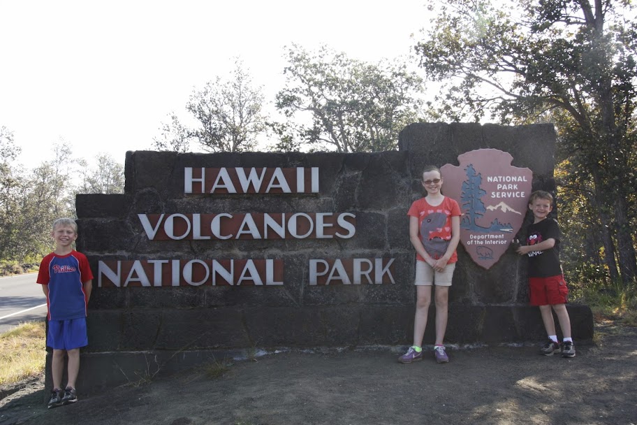
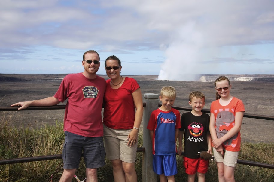
Finally, we made it. Heres the obligatory pictures or it didnt happen shot for documentation purposes.
Hawaii Volcanoes National Park was established in 1916 and covers over 500 square miles of land, stretching from Mauna Loa all the way east to the ocean and encompassing Kilauea and numerous other craters and hot spots. There are two main roads: Crater Rim Drive, which circles Kilauea Crater, and Chain of Craters Road, which extends down to the sea before being cut off abruptly by a 2003 lava flow. Kilauea has been active since March 2008, and so part of Crater Rim Drive has been closed downwind. Thats because the plume of gas coming out of the crater is sulfur dioxide, which is poisonous.
Unfortunately, the part of the road that is closed includes the Halemaumau overlook, from which you can peer into the deepest part of the crater and actually see the lava pool. They did set up a webcam so you can see what it looks like, though. Heres the link:
http://hvo.wr.usgs.gov/cams/panorama.php?cam=HMcam
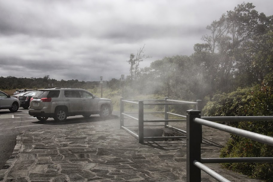
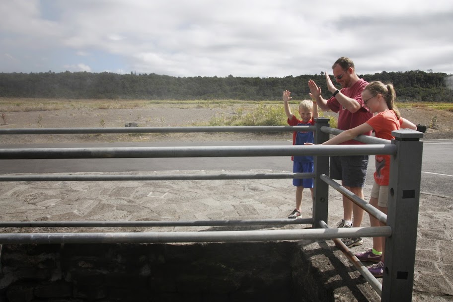
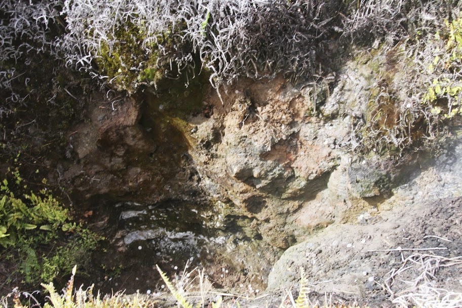
After a stop in the visitor center, we drove down the portion of Crater Rim Drive that was open and stopped at the first overlook. Here you can see various steam vents spewing hot gas from deep beneath the earths surface. I have to admit, its a little strange walking around and thinking about what might be happening underneath your feet.
The heat was pretty intense, actually. I could only hold my hand over it for a second or two.
Of course, this didnt prevent idiot tourists from tossing coins down into the vent. Whos the poor park ranger thats going to have to climb down in the heat to collect it?
Anyway, a short trail led us to our first glimpse of Kilauea itself.
Just a half-mile down the road was the Jaggar Museum, which afforded a view even closer to the volcano.
Inside the museum were some more exhibits.
Nerd Alert!!
This display showed the size of Mauna Loa relative to other famous mountains in the world.
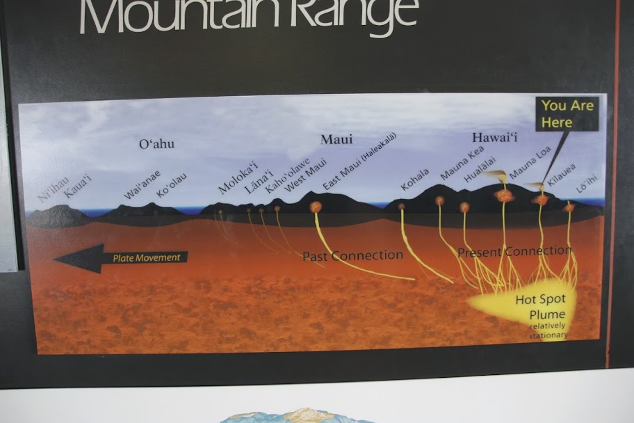
And this one gives a good picture of how plate tectonics allowed the Hawaiian islands to form through volcanic eruptions. Kauai and Niihau are the oldest islands, Hawaii is the youngest, and just to the east is Loihi--still underwater but probably the next island that will form in the chain.
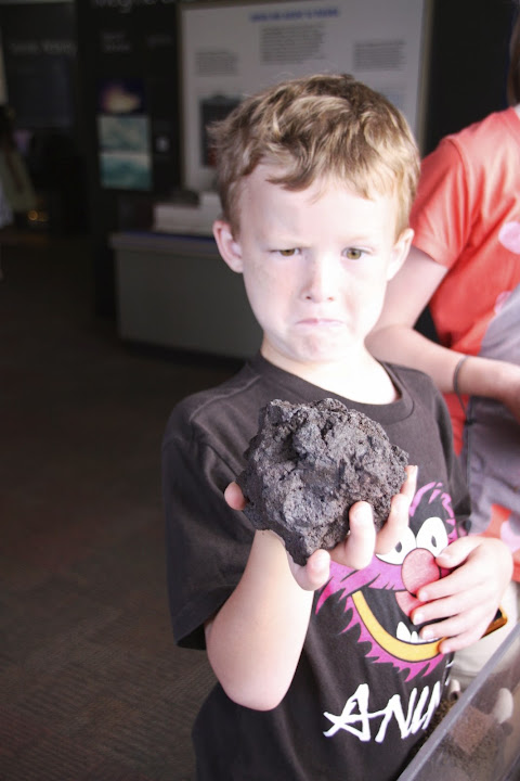
They had various samples of lava you could touch as well. Pahoehoe is smooth and gooey before it hardens as it cools, like natures version of the chocolate shell on your ice cream. Aa is rocky and chunky, which obviously makes it the Oreo crumbs in this tortured metaphor.
Nature has nothing similar to Scotty, though. He just happens.
End Nerd Alert.
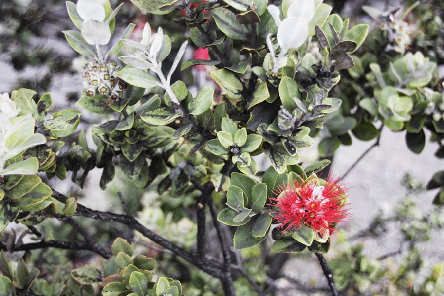
Outside the museum, Julie spotted this red spiky flower thingy:
And we also saw a clear view of the observatories on the summit of Mauna Kea.
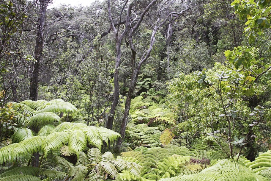
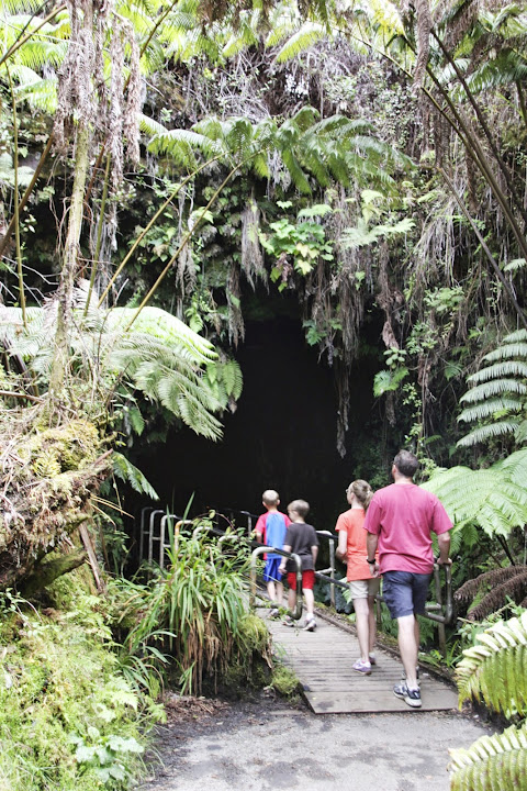
We left the museum and drove towards Chain of Craters Road. Dont worry, you havent seen the last of Kilauea. Our next stop was a trail for the Thurston Lava Tube. The trail led us through a dense tropical forest. Even though wed now been in Hawaii for almost 2 weeks, it was still stunning how quickly we could travel between dry, rocky terrain and lush jungle.
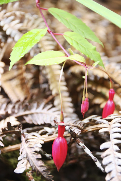
We also saw this red bulb-y flower thingy.
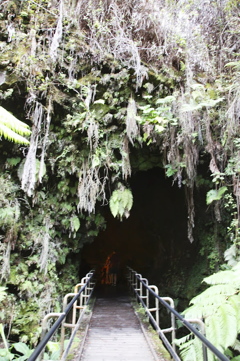
Heres the entrance to the lava tube. Raise your hand if, like me, you expected a guy in a leather jacket and a fedora and a giant boulder to come rolling out of this cave at any moment.
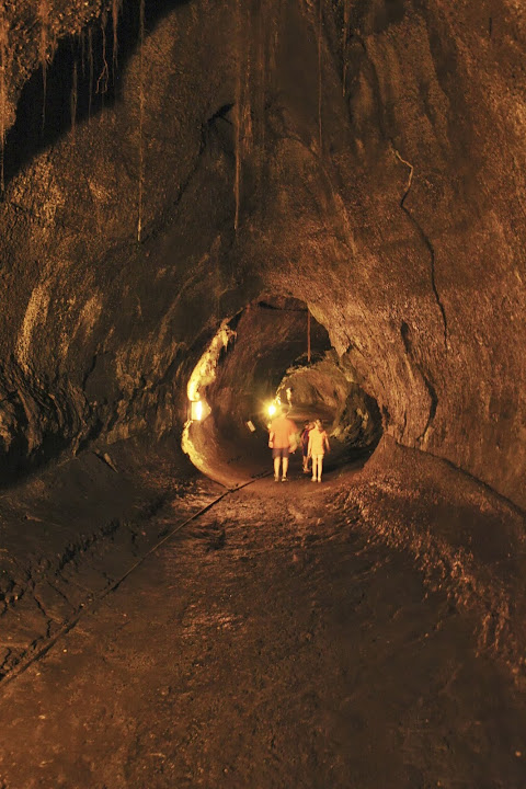
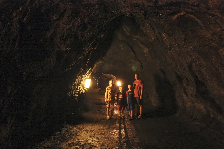
The lava tube was formed when conditions cause the surface of a lava flow to cool, while the rest still flows underneath. Eventually it empties and leaves the empty cave behind. In this case, it left behind a 1/2-mile hike through a dark cave. Theres not much else to say except its really cool inside. Literally and figuratively speaking.
At this point, it was still mid-morning and we had a lot more of the park to cover. And no snacks or lunch supplies in the car.
Coming Up Next: Hikes! More hikes! And did I mention that this park is in the middle of nowhere with few options for lunch available?


 Now I know what to get you for Christmas!

 Liesa! So great to have you back here.
")