lucas
°o°
- Joined
- Jul 29, 2005
- Messages
- 24,127
Don't really know who "Mike" is. But, here is his latest posting:
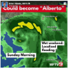
Latest 12z rain models from weathermodels.com through Saturday night. Central Florida stil looking to get a break for the start of the weekend at least. South Florida starts getting it Friday with some high totals possible when our system pops north of the Yucatan. No changes in thinking... just a sloppy holiday rainmaker. GFS coming in line with others and appears whatever Invest 90 becomes crosses the Upper Gulf Sun/Mon as a slow mover. New Orleans to Pensacola is my range right now. Lots of rain expected up there early in the week and still thinking TD/TS at most.... with the majority of rains to the east side. Some west coast Florida waves/wind to watch out for. www.spaghettimodels.com / Mike's Weather Page
Latest 12z rain models from weathermodels.com through Saturday night. Central Florida stil looking to get a break for the start of the weekend at least. South Florida starts getting it Friday with some high totals possible when our system pops north of the Yucatan. No changes in thinking... just a sloppy holiday rainmaker. GFS coming in line with others and appears whatever Invest 90 becomes crosses the Upper Gulf Sun/Mon as a slow mover. New Orleans to Pensacola is my range right now. Lots of rain expected up there early in the week and still thinking TD/TS at most.... with the majority of rains to the east side. Some west coast Florida waves/wind to watch out for. www.spaghettimodels.com / Mike's Weather Page


