Captain_Oblivious
DIS Dad #257, Galactic Salad Dodger
- Joined
- Nov 10, 2008
- Messages
- 13,455
Chapter 8: The Way Back to Town is Only Seventy Miles. So if You Save Your Breath, I Feel a Man Like You Can Manage it.
I love Utah.
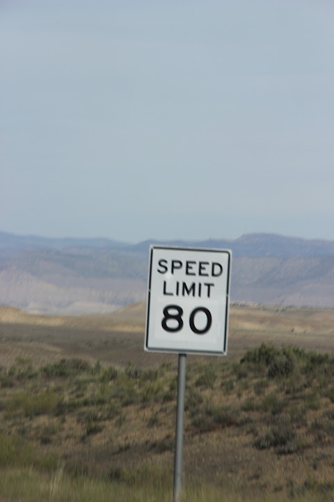
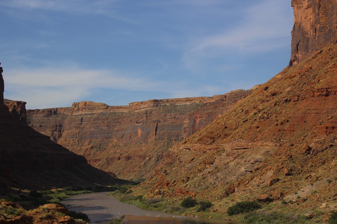
We were on our way to Moab. There are two ways to get there from Grand Junction, Colorado. The first is to follow the main highways, I-70 west to U.S. 191 south. That’s the boring way. Or you can exit the interstate early and follow Rt. 128 into town. That’s the route we took.
When you go this way, it first feels like a mistake. You drive along a road that is barely wide enough for a minivan and looks like it was last paved when they closed the Oregon Trail. Then you pass through the town of Cisco, which appears to have been last inhabited during the heyday of the Oregon Trail. Well, that’s not quite true. There are a lot of abandoned cars near the abandoned buildings, so it must have lasted a little while longer.
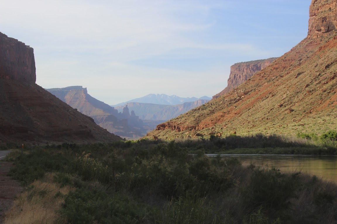
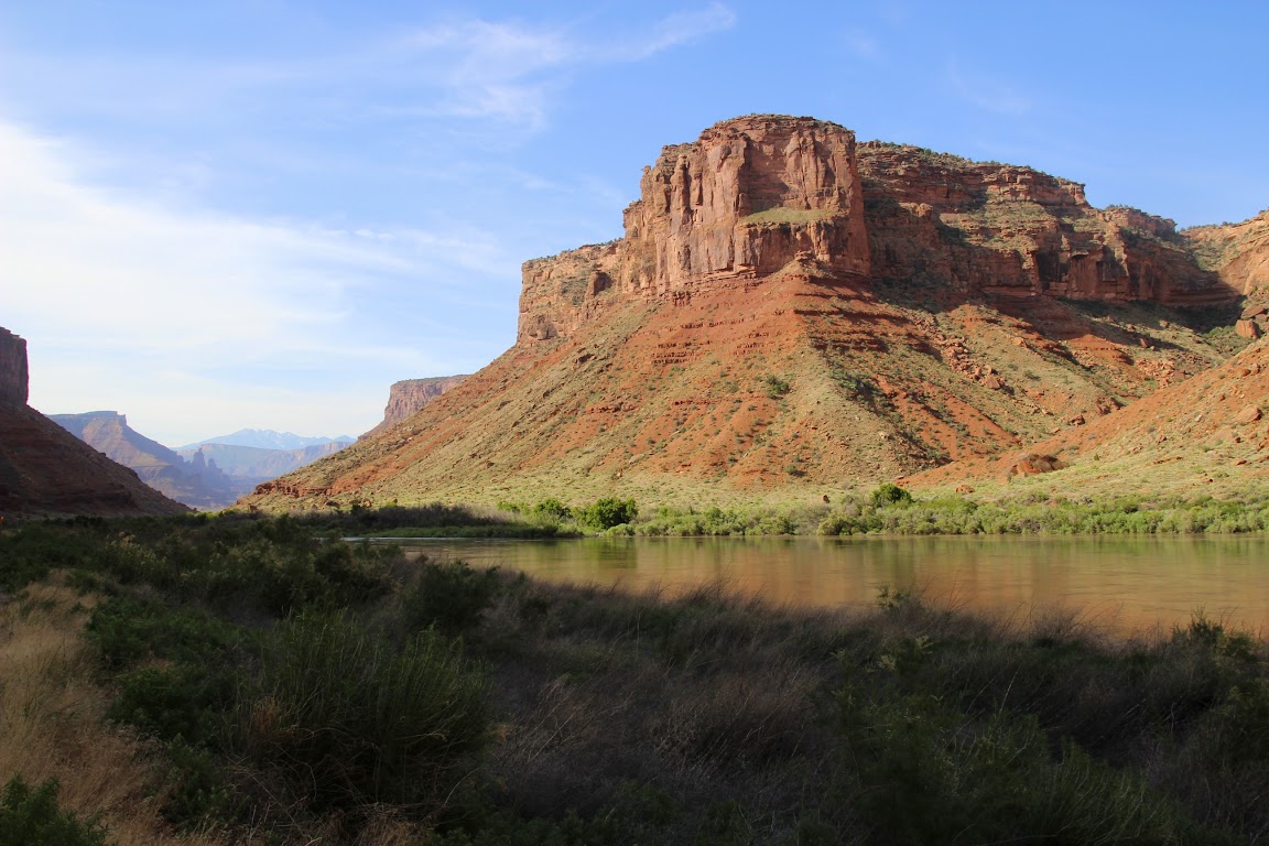
Anyway, give it time. Eventually the road meets up with the Colorado River, and you get to follow the river into Moab as it carves its way through red rock canyons. It’s a spectacular drive and much, much, much more scenic than the main road. Welcome to Utah.
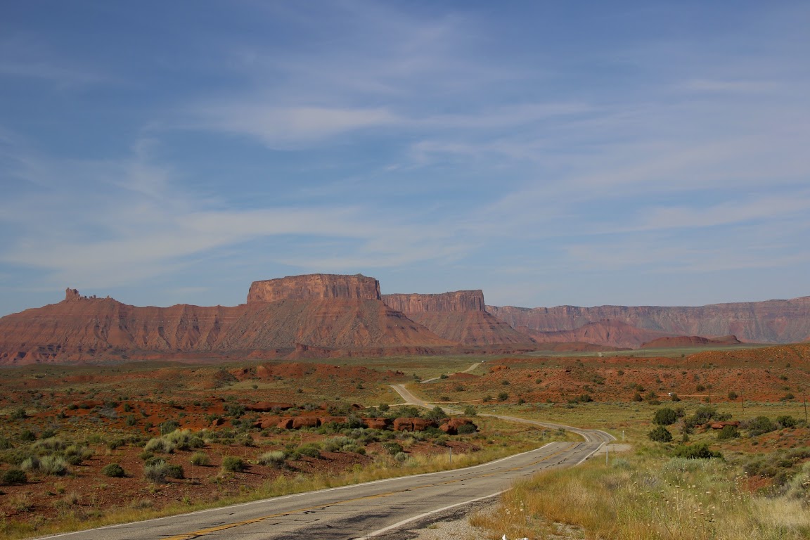
When we arrived in Moab, we stopped for fuel and natural bodily functions and then turned north. Just a few miles north of town, you make a left and then you’re on the road to Canyonlands National Park. It’s approximately 30 miles to the park border from town.
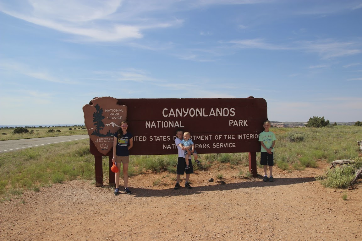
Canyonlands is a large park, divided into three separate sections: The Maze, The Needles, and Island in the Sky. Due to driving distances, you’d need at least a couple of days to explore the various sections. Many areas are only reachable via hiking or off-road vehicles. We decided to concentrate on the Island in the Sky section of the park.
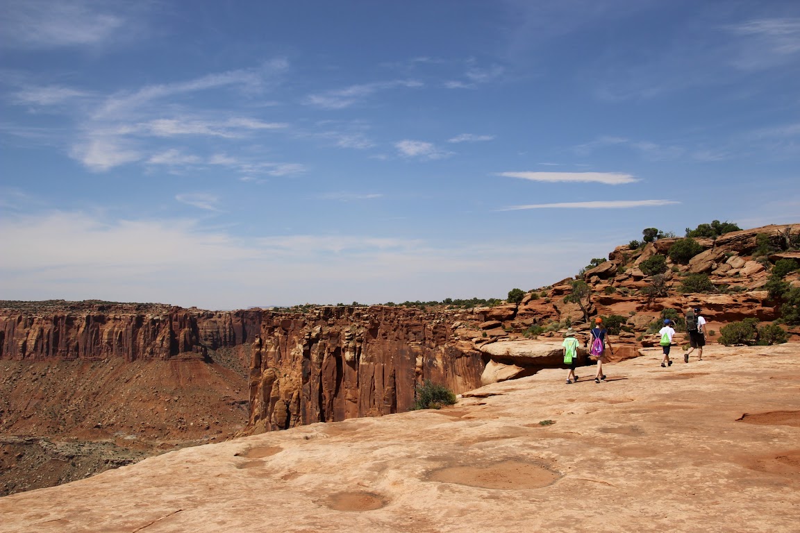
Normally we would have made the visitor center our first stop. However, this was the desert. In the summer. The high temperatures were approaching 100 degrees. And we had wanted to do a little hiking. Best to get that done as early as possible. So we drove all the way in, 10 miles down to the end of the road at Grand View Point. We got there around 10:00 a.m., so it was “only” 90 degrees outside. But hey, it was a dry heat.
The hike to Grand View Point is about a mile each way, but it’s fairly flat. It’s a fun hike because you can walk right up to the canyon edge if you like (Julie didn’t like that) and climb on some rocks at the end to get a view of a gorgeous vista. This would be my second attempt at hiking with the baby strapped to my back, but the first in desert heat. Needless to say, we took plenty of water with us.
I had attempted to “train” for these hikes by putting Baby Drew into the backpack and walking around the neighborhood with him. In Delaware, the average elevation change over a couple of miles is roughly 2 inches. So training in this manner was similar to training for an Iron Man triathlon by driving myself to the grocery store.
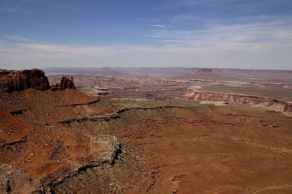
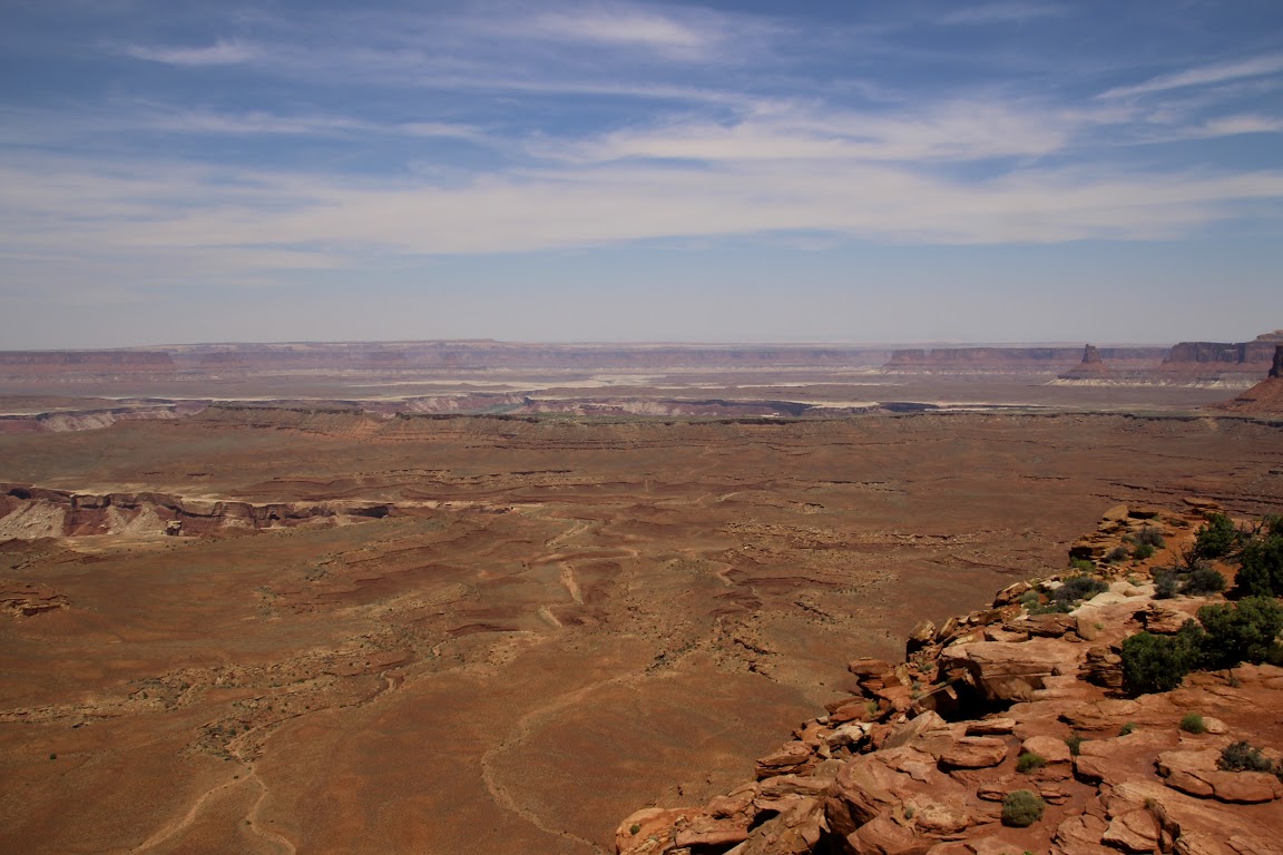
The views? Yeah, they were ok, I guess.
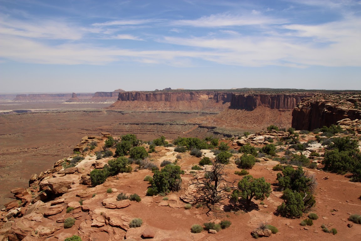
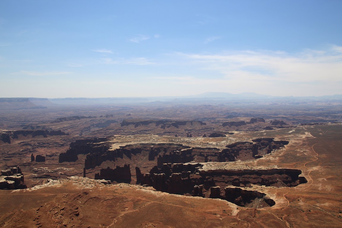
The hike really wasn’t bad at all, even with Baby Drew gnawing on my tee shirt. At the end of the trail we were treated to views such as these:
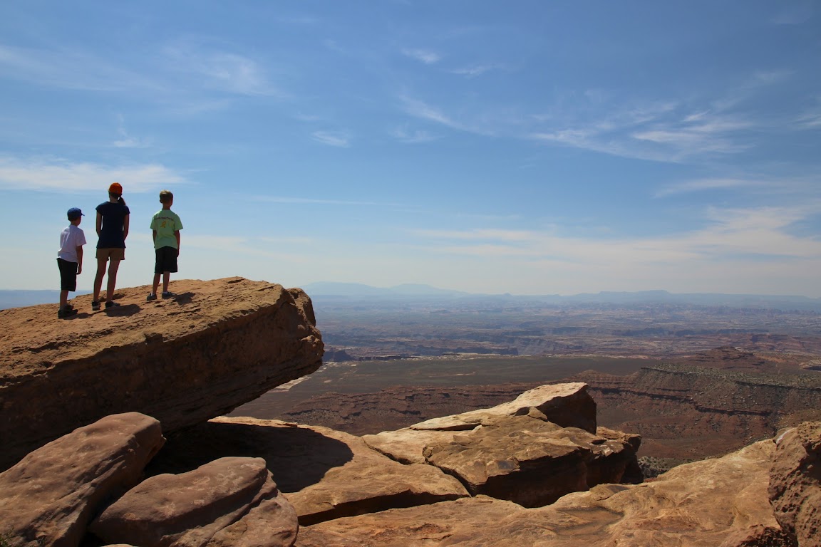
I got to take the backpack off for some blessed relief for my aching shoulders. Julie sat with the baby in some shade while the older kids and I went rock climbing.
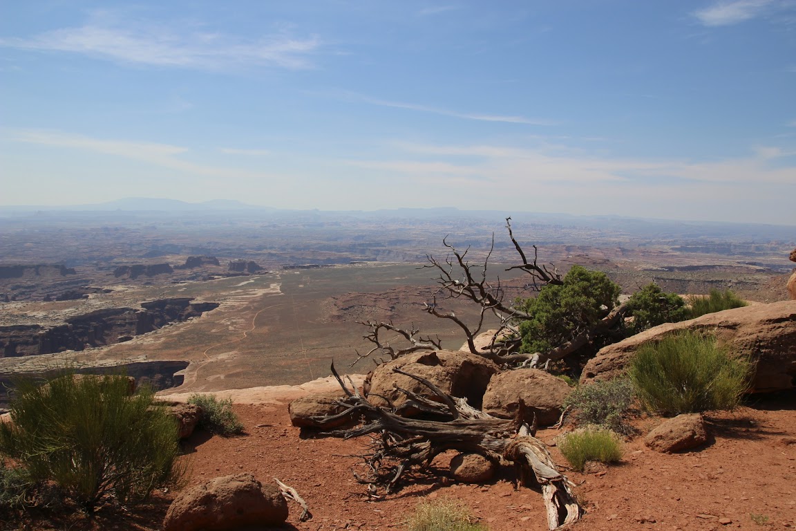
Somewhere down there is the confluence of the Colorado and Green Rivers.
As you can imagine, we just kept taking photos. It just so happened that this was Father’s Day, and I was spending it with my family taking in these sights. You could do much, much worse.
At the time, Baby Drew had only one word: “Hot!” We heard it quite a bit on the trip, such as whenever we would get into the minivan after it had been sitting out all day. In the words of Baby Drew, this hike was “HOT!” This is why his sippy cup appears in all of our photos.
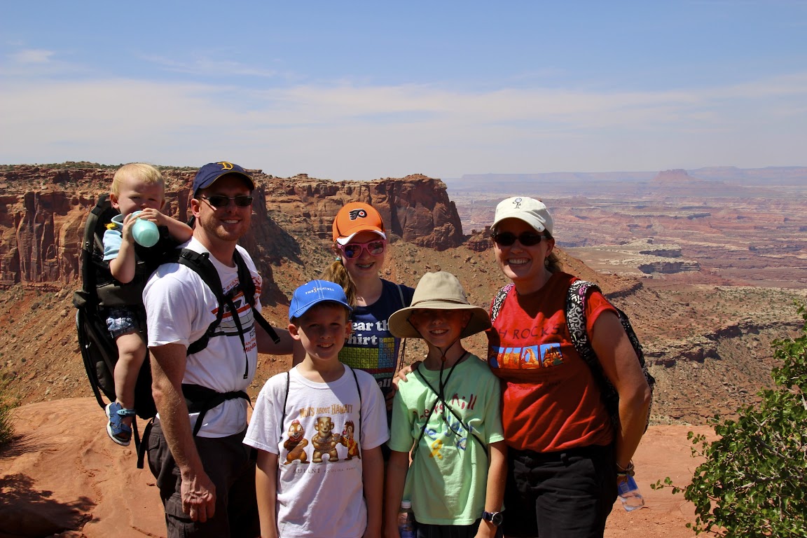
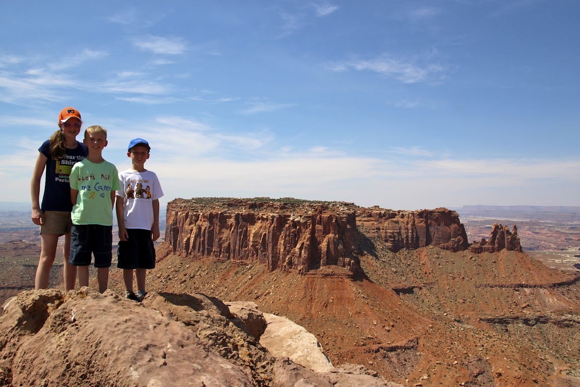
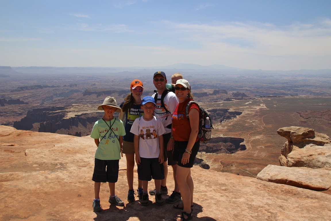
Let’s take another look at those lovely family photos. The composed shot:
Behind the scenes:

Yikes. Remind me not to get on Sarah’s bad side. That’s some professional stink-eye, even through the sunglasses.
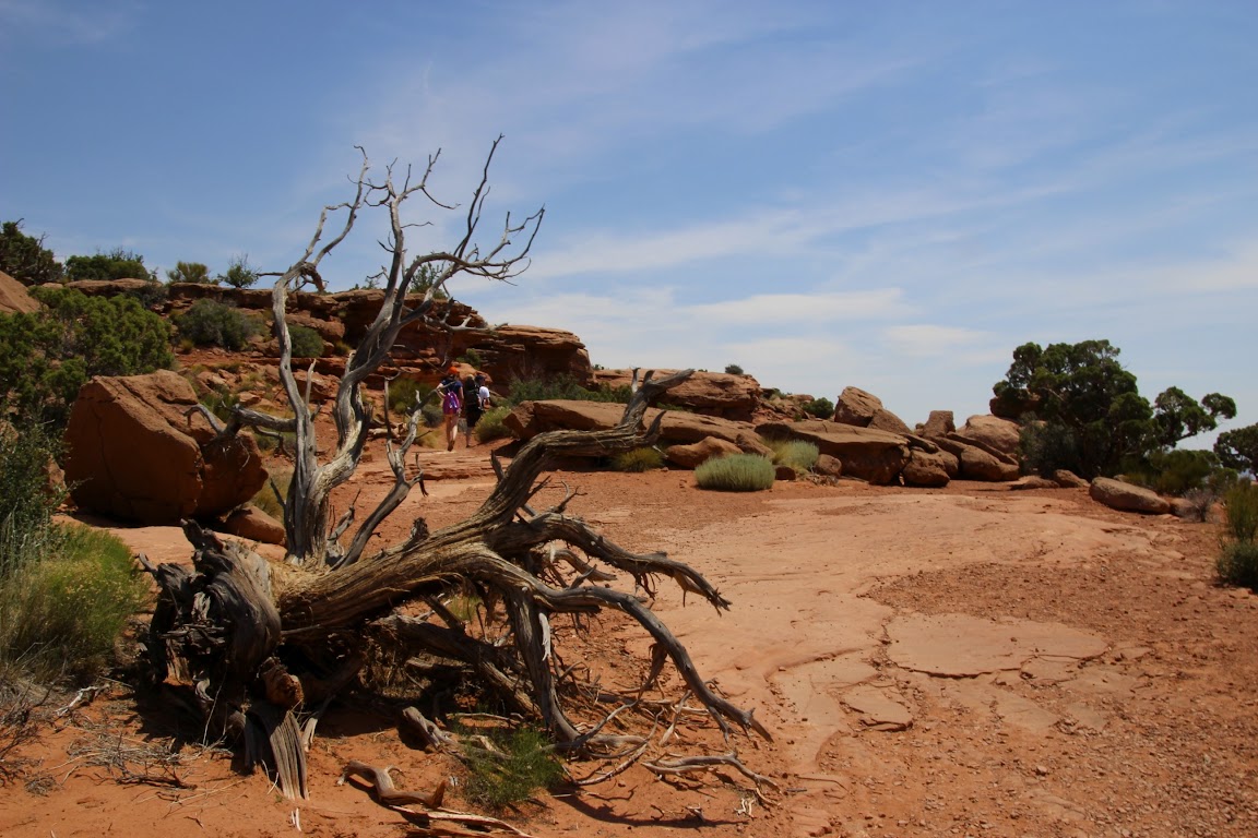
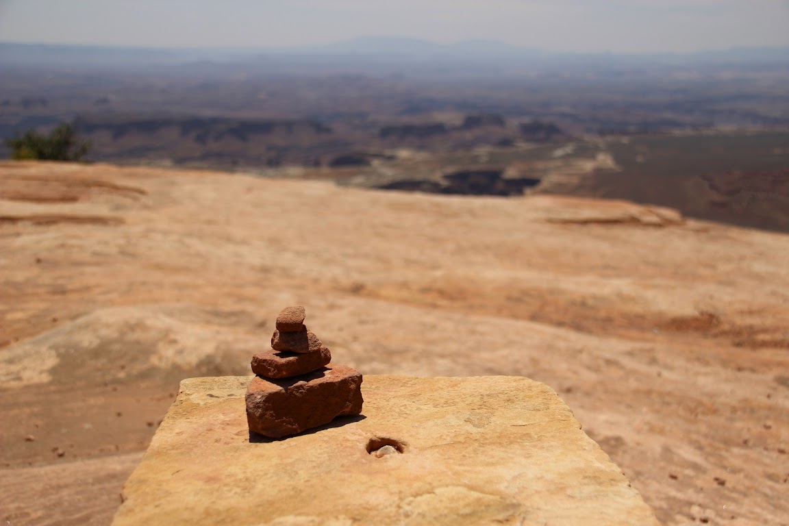
We eventually headed back the way we came. Trails are marked by small cairns, or rock piles. The kids left a few of their own.
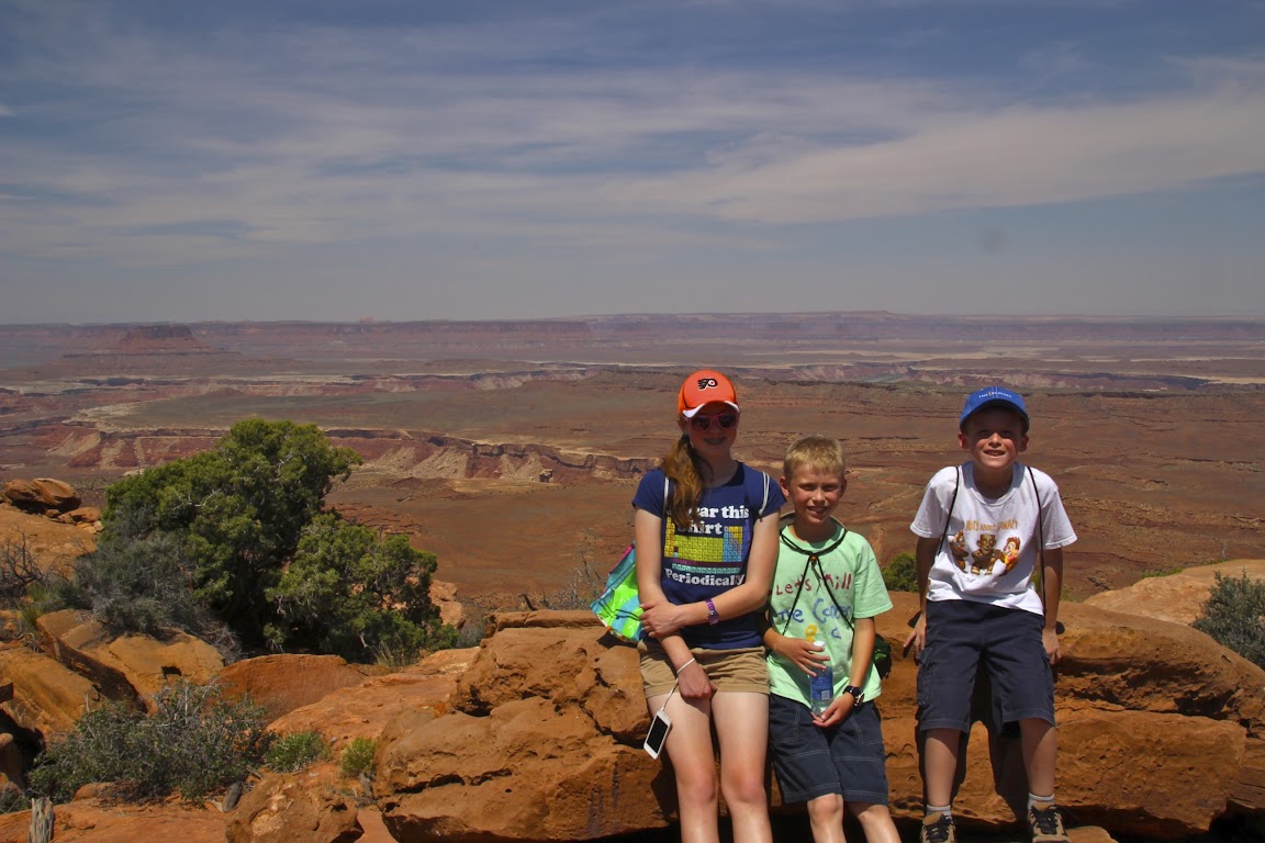
Family photo time. Baby Drew almost made it into this one!
This is a formation known as the dinosaur footprint. I’d say it’s more like a Godzilla footprint.
We made it back to the van by lunchtime, where it was time for—you guessed it!—PB&J sandwiches. And lots and lots of water. Still, we all agreed that finishing the hike by noon was well worth it. Some people were just starting out on the trail and by that time you could really feel the sun beating down. We felt a great deal of compassion for them as we loaded into the van and cranked up the air conditioning. I think we shouted, “Suckers!” only a few dozen times as we watched others begin the march.
Coming Up Next: Tired of canyon photos yet?
I love Utah.
We were on our way to Moab. There are two ways to get there from Grand Junction, Colorado. The first is to follow the main highways, I-70 west to U.S. 191 south. That’s the boring way. Or you can exit the interstate early and follow Rt. 128 into town. That’s the route we took.
When you go this way, it first feels like a mistake. You drive along a road that is barely wide enough for a minivan and looks like it was last paved when they closed the Oregon Trail. Then you pass through the town of Cisco, which appears to have been last inhabited during the heyday of the Oregon Trail. Well, that’s not quite true. There are a lot of abandoned cars near the abandoned buildings, so it must have lasted a little while longer.
Anyway, give it time. Eventually the road meets up with the Colorado River, and you get to follow the river into Moab as it carves its way through red rock canyons. It’s a spectacular drive and much, much, much more scenic than the main road. Welcome to Utah.
When we arrived in Moab, we stopped for fuel and natural bodily functions and then turned north. Just a few miles north of town, you make a left and then you’re on the road to Canyonlands National Park. It’s approximately 30 miles to the park border from town.
Canyonlands is a large park, divided into three separate sections: The Maze, The Needles, and Island in the Sky. Due to driving distances, you’d need at least a couple of days to explore the various sections. Many areas are only reachable via hiking or off-road vehicles. We decided to concentrate on the Island in the Sky section of the park.
Normally we would have made the visitor center our first stop. However, this was the desert. In the summer. The high temperatures were approaching 100 degrees. And we had wanted to do a little hiking. Best to get that done as early as possible. So we drove all the way in, 10 miles down to the end of the road at Grand View Point. We got there around 10:00 a.m., so it was “only” 90 degrees outside. But hey, it was a dry heat.
The hike to Grand View Point is about a mile each way, but it’s fairly flat. It’s a fun hike because you can walk right up to the canyon edge if you like (Julie didn’t like that) and climb on some rocks at the end to get a view of a gorgeous vista. This would be my second attempt at hiking with the baby strapped to my back, but the first in desert heat. Needless to say, we took plenty of water with us.
I had attempted to “train” for these hikes by putting Baby Drew into the backpack and walking around the neighborhood with him. In Delaware, the average elevation change over a couple of miles is roughly 2 inches. So training in this manner was similar to training for an Iron Man triathlon by driving myself to the grocery store.
The views? Yeah, they were ok, I guess.
The hike really wasn’t bad at all, even with Baby Drew gnawing on my tee shirt. At the end of the trail we were treated to views such as these:
I got to take the backpack off for some blessed relief for my aching shoulders. Julie sat with the baby in some shade while the older kids and I went rock climbing.
Somewhere down there is the confluence of the Colorado and Green Rivers.
As you can imagine, we just kept taking photos. It just so happened that this was Father’s Day, and I was spending it with my family taking in these sights. You could do much, much worse.
At the time, Baby Drew had only one word: “Hot!” We heard it quite a bit on the trip, such as whenever we would get into the minivan after it had been sitting out all day. In the words of Baby Drew, this hike was “HOT!” This is why his sippy cup appears in all of our photos.
Let’s take another look at those lovely family photos. The composed shot:
Behind the scenes:
Yikes. Remind me not to get on Sarah’s bad side. That’s some professional stink-eye, even through the sunglasses.
We eventually headed back the way we came. Trails are marked by small cairns, or rock piles. The kids left a few of their own.
Family photo time. Baby Drew almost made it into this one!
This is a formation known as the dinosaur footprint. I’d say it’s more like a Godzilla footprint.
We made it back to the van by lunchtime, where it was time for—you guessed it!—PB&J sandwiches. And lots and lots of water. Still, we all agreed that finishing the hike by noon was well worth it. Some people were just starting out on the trail and by that time you could really feel the sun beating down. We felt a great deal of compassion for them as we loaded into the van and cranked up the air conditioning. I think we shouted, “Suckers!” only a few dozen times as we watched others begin the march.
Coming Up Next: Tired of canyon photos yet?

 Take a baby on a dessert vacation and what's the word he learns: HOT!

 Learned it on that trip, I presume?
 "I will kill you and it will be slow. You've been warned."
 Agreed!


") Beautiful country....I bet it was hot!
Beautiful country....I bet it was hot! 
 :rolleyes:")
