Chapter 16: That Ball Wouldn’t Have Made It Out Of A Lot Of Parks.
Name One.
Yellowstone.
We’d done it. We’d found an incredible place to stay, and it was right in the heart of the major tourist center of Yellowstone National Park. We were within walking distance of almost every single famous geyser the park had to offer.
Naturally, the first thing we did the next morning was scarf down some donuts in the room, buy some coffee at the snack bar, and then hop in the van and drive off.
Why? Well, there’s more to see in Yellowstone than just the geyser basin. In fact, there is more than one geyser basin. As I mentioned in the previous chapter, Yellowstone is a huge park. Our plan was to try and cover most of the park’s “other” attractions on this day, get the driving out of the way, and then have an easier second day, which was to be spent exploring the main geysers. Sounded good on paper.
So, we left in the early morning hours, headed for the Canyon Village section of the park on the eastern side. The main road system of the park is
set up in a giant figure 8. Old Faithful is on the southwestern part of the lower loop in the 8, and the canyon village is right on the eastern center. It would be a 42-mile drive, and we wanted to get there while we still had some good morning light.
It was a beautiful morning, cool (temps typically sit in the 40’s at night) and crystal clear. It always feels a little weird to be wearing sweatshirts in summer. Weirder still if you’ve spent a couple of days previously hiking in 100-degree temperatures in the desert. Not that we were complaining.
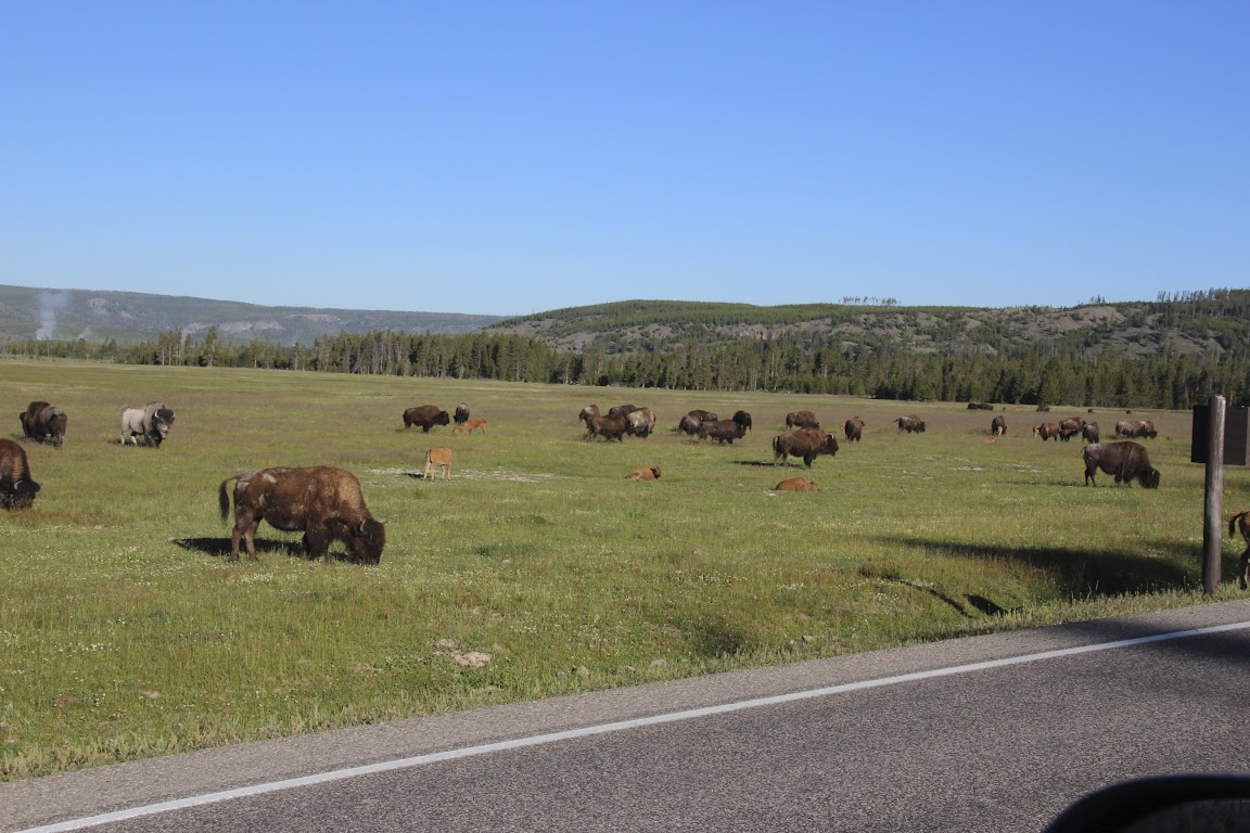
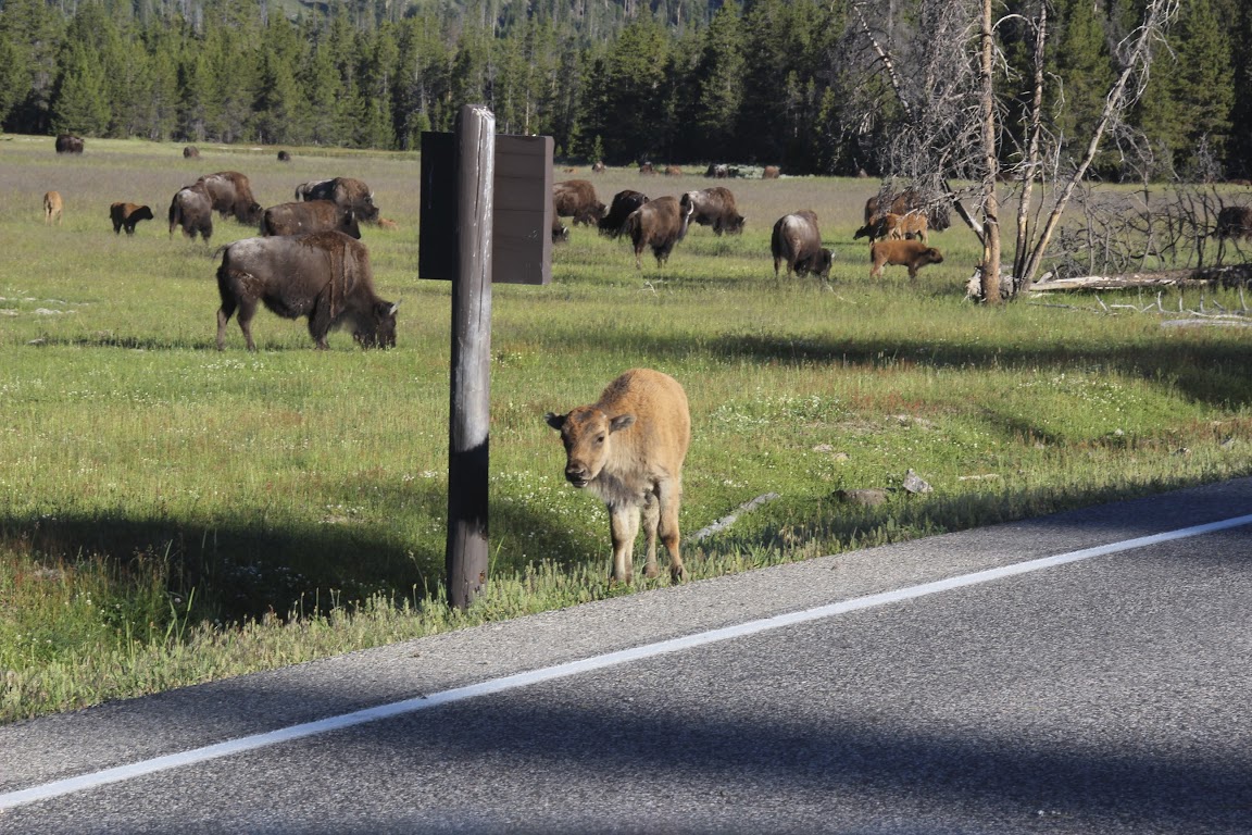
Along the way, near Madison Junction, we came across a huge clearing in the forest. And in that clearing was a huge herd of bison—and several baby bison roaming among them.
We sat, quietly amazed for a few minutes. Seeing these amazing creatures up close was a special experience, so we certainly weren’t going to rush.
Hey, little guy! Please tell me your mom is not behind me right now.
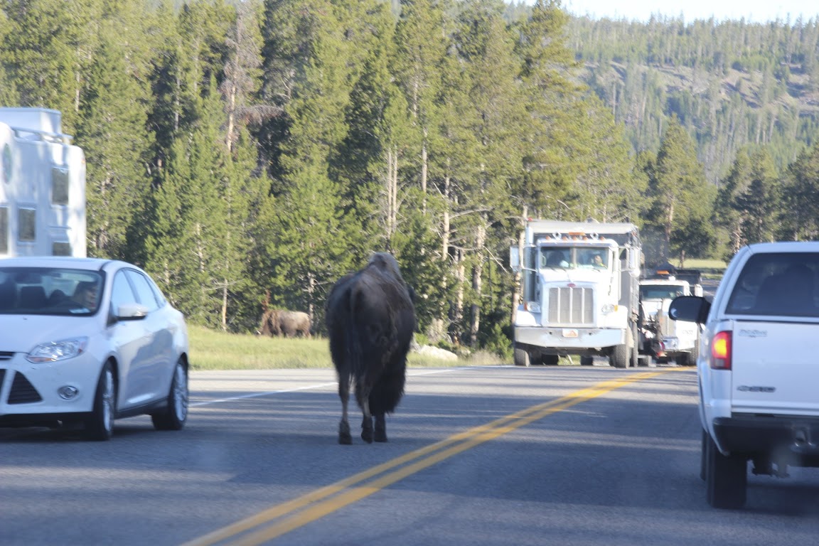
Just down the road, we encountered our first Yellowstone traffic jam. These happen quite frequently throughout the day, and there’s not much you can do but wait it out. I suppose you could try and roll down your window and yell at the offending party, or even get out of your car to try and move him off the road, but…well, I wouldn’t recommend it.
Where does a 2-ton bison go on the highway? Anywhere it darn well pleases.
Eventually, he went on his way and traffic was moving again. Sometime later we reached the eastern side of the park. We drove directly to an overlook known as Artist Point.
Being an engineer, I’m a fairly direct, literal kinda guy. I’m not one to typically do well in literature class. I don’t pick up on symbolism and metaphors very well. If I read about a man who looks longingly at a stream peacefully flowing through the woods, I’m not going to read that as his momentary reflection upon and longing for a bygone youth spent in innocence and at one with nature. I just think he’s thirsty.
By the way, here’s an engineer’s tip for surviving conversations on the arts. Whenever someone brings up Shakespeare, just say the following phrase:
“No writer spoke to the human condition like William Shakespeare.”
It’s a guaranteed conversation-ender and subject-changer. It sounds deep, but nobody has any idea what that actually means. I don’t even know what it means. However, no one will want to risk looking stupid by asking what it means, so you’ll get a lot of profound-looking nods, an awkward pause, and then you can safely bring up last night’s football game. Trust me.
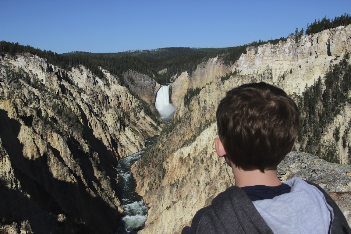
Anyway, I mention this because I really appreciate it when someone gives a place a descriptive name like “Artist Point”. That tells me, Mr. Literal, that artists like to set up camp here, so there must be something worthwhile that you can see from this point. Nice and simple. I like that.
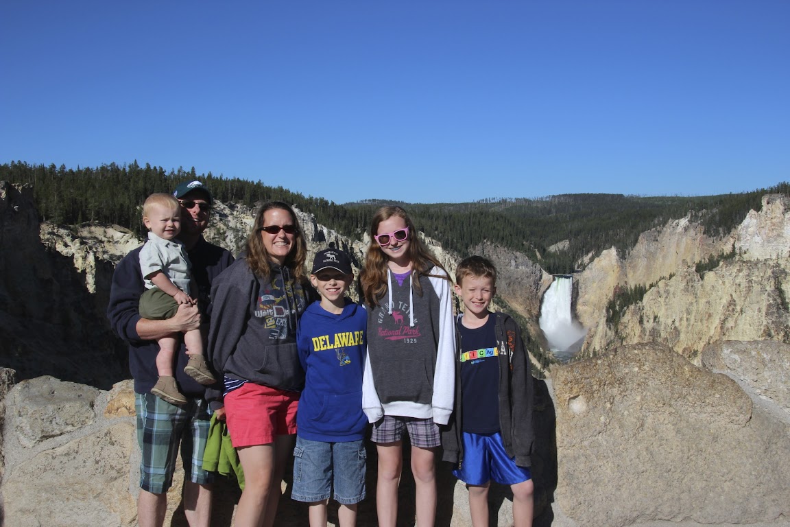
We parked in the parking lot, being one of the very first arrivals that morning (I love beating the crowds). There’s a very short trail to follow before you reach the overlook.
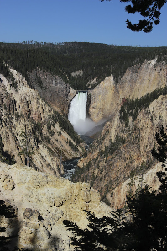
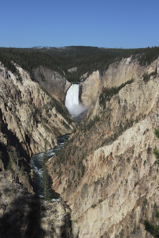
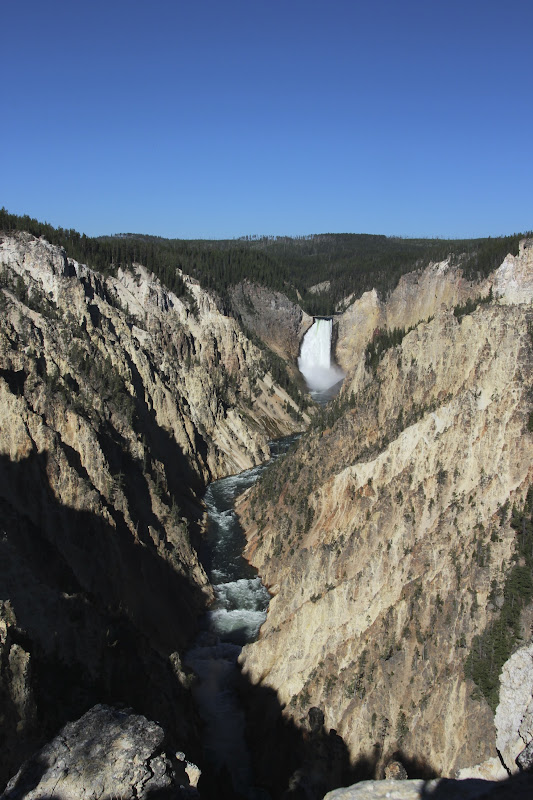
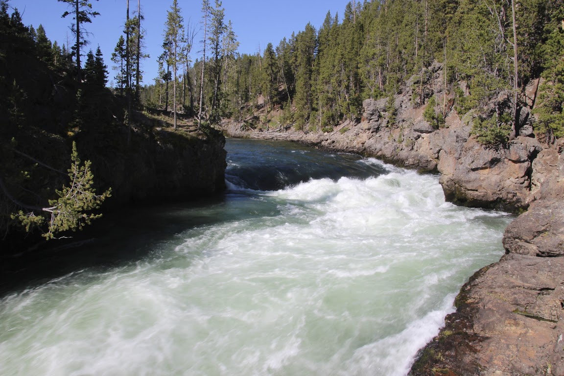
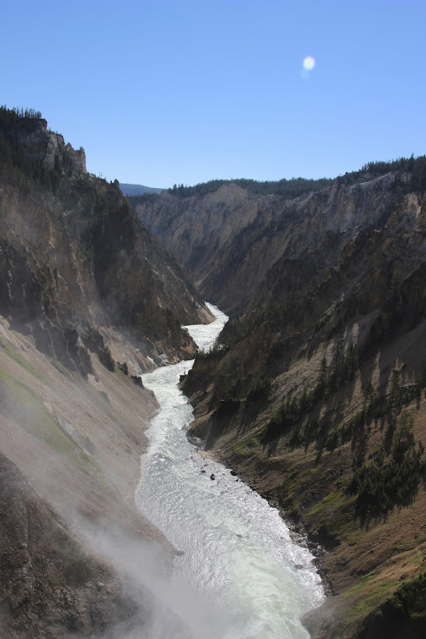
Artist Point gives you a view of the Lower Falls of the Yellowstone River. It’s carved a canyon over many years through rock that has been tinted in several different colors by minerals from the park’s thermal features. The primary color is yellow, thus giving the park its name. This spot is the most breathtaking sight in the park. In fact, it’s one of the most breathtaking sights I’ve seen in the world.
The Lower Falls is the tallest waterfall in the park—308 feet, more than twice the drop of Niagara Falls. Even from this distance, the roar of the water gushing over the falls was unmistakable. The panorama from here was truly unforgettable. Please forgive me while I indulge in a few photos. You just can’t stop taking pictures at a place like this. I could have stared for hours.
Obviously, we’d arrived early because we not only wanted to beat the crowds, but we had wanted to catch the falls in the morning light before it was covered in shadows the rest of the day.
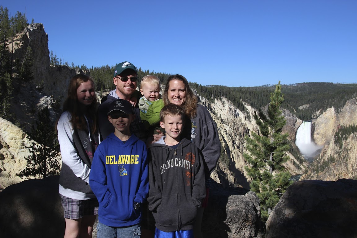
You can see in that last photo that Baby Drew thought this was a special occasion, too. He even wore his Junior Park Ranger outfit.
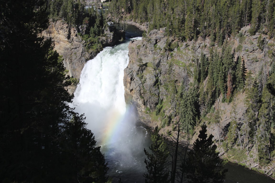
Using my advanced deductive reasoning skills, I figured that if there was a Lower Falls, there must be an Upper Falls as well. Not only that, but there were signs pointing the way. A short drive down the road led to another overlook.
That one’s only 109 feet high. Pfffft.
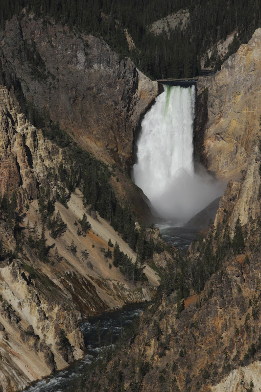
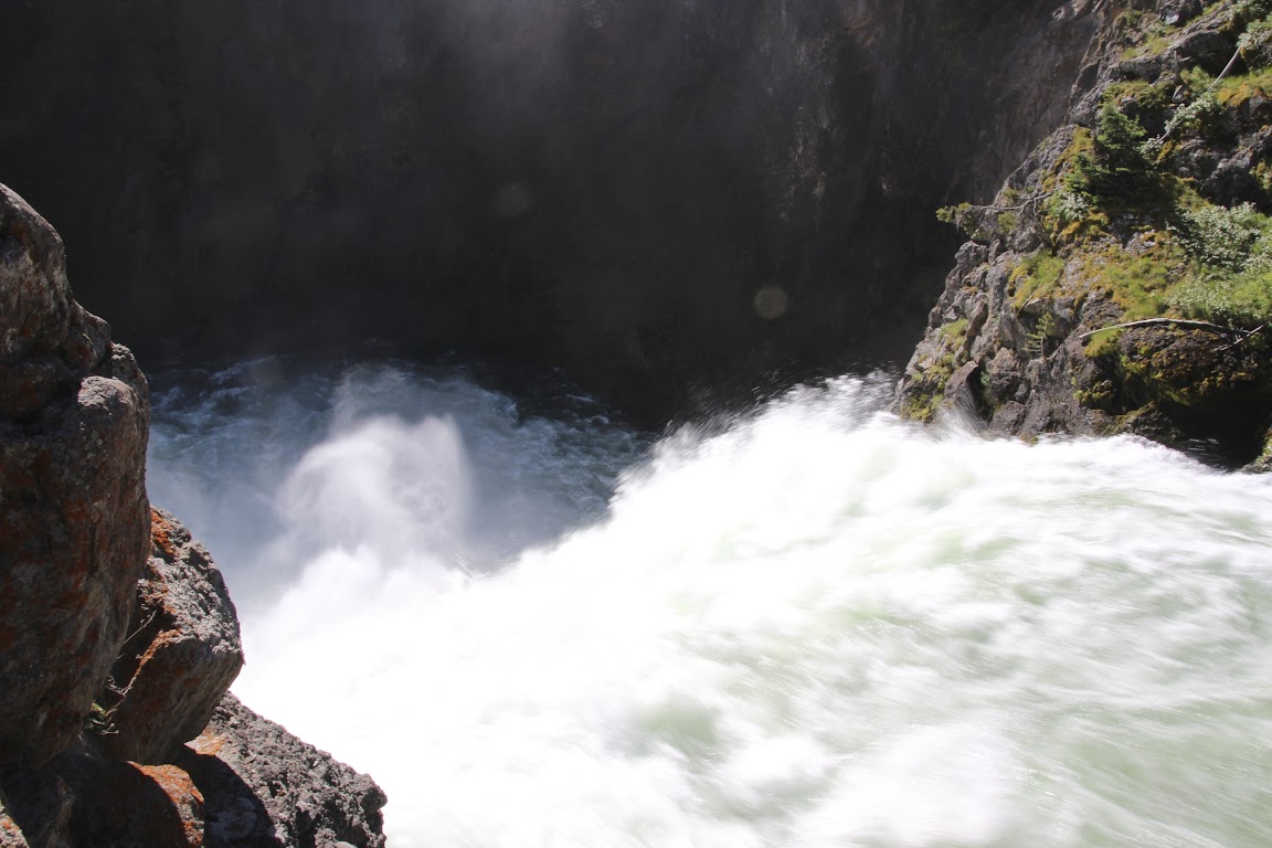
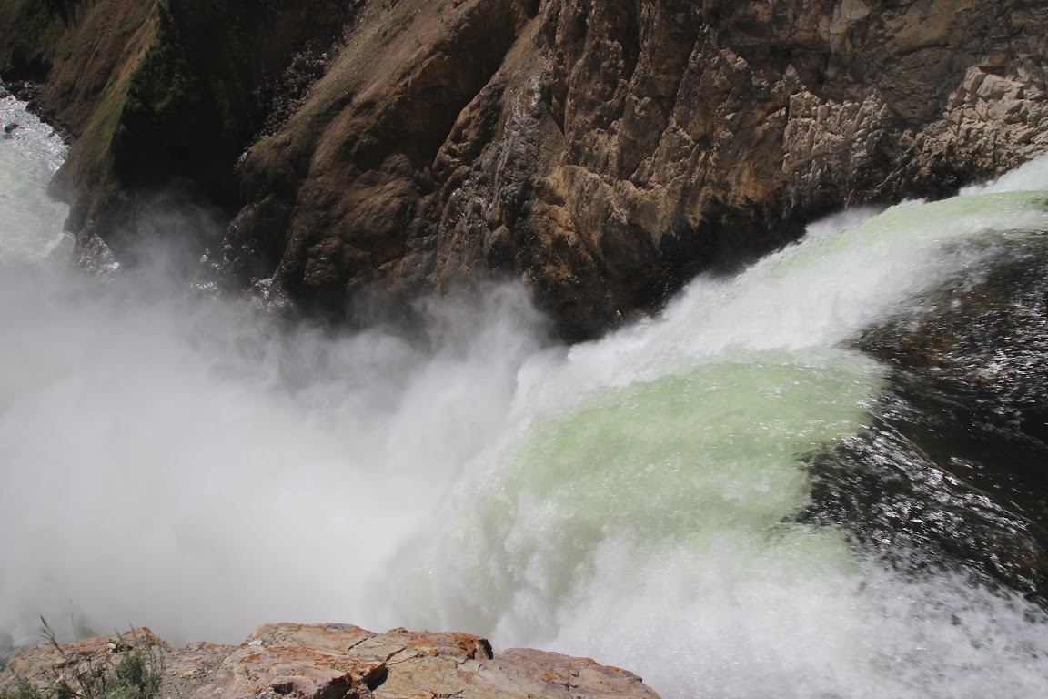
If you cross the river to the northern side, there are a couple of trails leading to the brink of each waterfall. Being the completists that we are, we set out for the Brink of the Upper Falls first. This is a short, easy walk that leads here:
The sheer power of the water flowing over the edge was even more evident here.
We ran into a large group of Asian tourists piling out of a bus at this overlook. I have to say, they were as hardcore as we were about seeing the sights. In the early morning hours, the only other people we consistently saw out and about were the Asian tour groups. They don’t mess around!
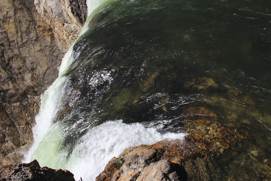
We moved on to the trail to the Brink of the Lower Falls. Looking at the map, it appeared to consist of a few switchbacks down the slope to the viewpoint. The map did warn that it was a steep trail, but we figured after Delicate Arch we could handle a few switchbacks. I once again strapped the baby to my back and set off.
Immediately, we knew that the climb out was going to be a beast. The trail itself is 0.75 miles round trip. But it’s 1/8th of a mile down and 17 miles coming back (approximate).
The trail consists of 12 or 13 switchbacks down the slope connected by steep inclines. So we pretty much raced down the slope, knowing the whole way that it was going to be painful coming back out. Still, we made it to the brink of the falls, and I think it was worth the effort.
Doesn’t look like 309 feet from here, does it?
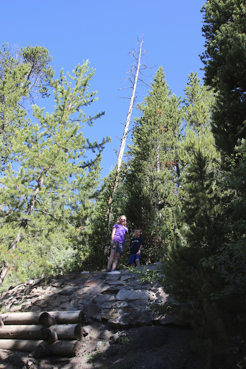
Having seen the falls from every conceivable angle, we made our slow and painful climb back up. To give you an idea of the climb, here are Sarah and Scotty just ahead of us after passing one switchback.
We saw several people coming down, asking “how much farther?” All we could think was that if you were getting tired on the way down, good luck going back up!
At long last we made it back to the van, where I could once again happily throw the backpack in the back seat. We stopped at the Canyon Village visitor center to rest a bit, use the restroom, and most importantly, grab some snacks. This hiking stuff will really give you an appetite, and we still had a lot of park to cover in the afternoon.
Coming Up Next: Mammoth Hot Springs, our first geysers, and cheating a bit to pick up another state.
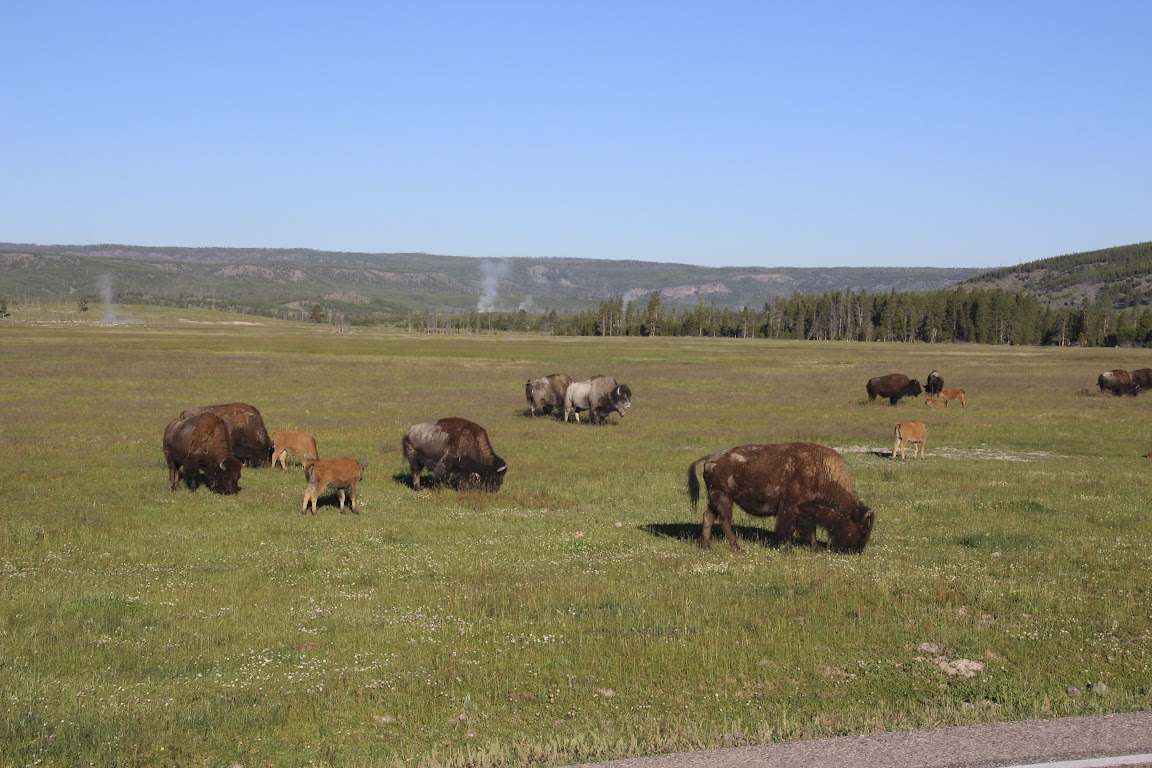
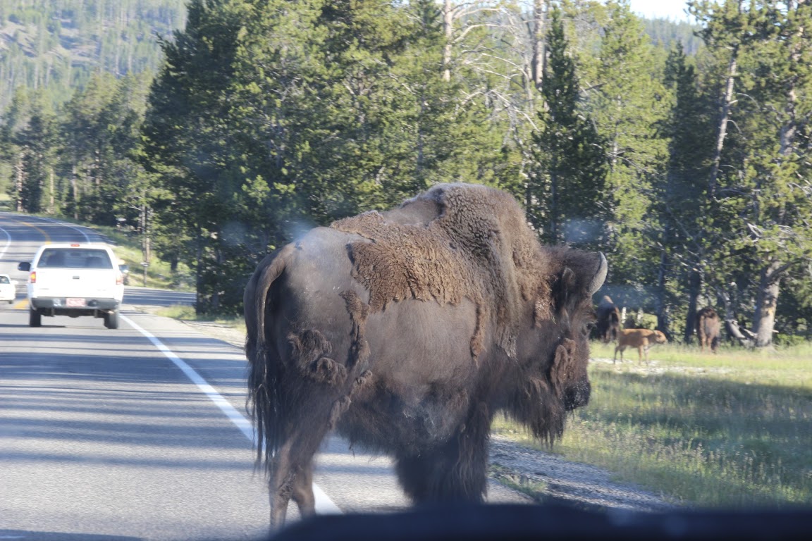

 Why do I get the feeling if someone did try to get him out of the way, the bison would probably just ignore him.
") Wish I had more time to comment and heckle, but my tamales are done and it's nearly time to sit down to our early extended family Christmas dinner. Merry Christmas, Friends!!!!
Wish I had more time to comment and heckle, but my tamales are done and it's nearly time to sit down to our early extended family Christmas dinner. Merry Christmas, Friends!!!!

 Dam! Wish I would have thought of that.


 Good job!